The Silk Odyssey
  • Blog
  • CHINA
  • TIBET
  • CENTRAL ASIA
  • IRAN
  • EGYPT
  • JORDAN
  • LEBANON
  • TURKEY
  • VISA'S & BORDER CROSSINGS
  • About

SOUTHEAST TURKEY:  NOT YOUR TYPICAL TOURIST TRAIL (PART ONE)

14/9/2015

6 Comments

 
Picture
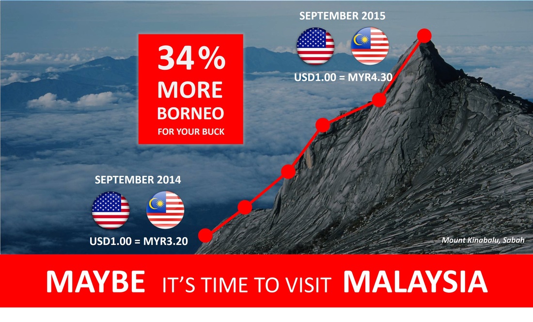
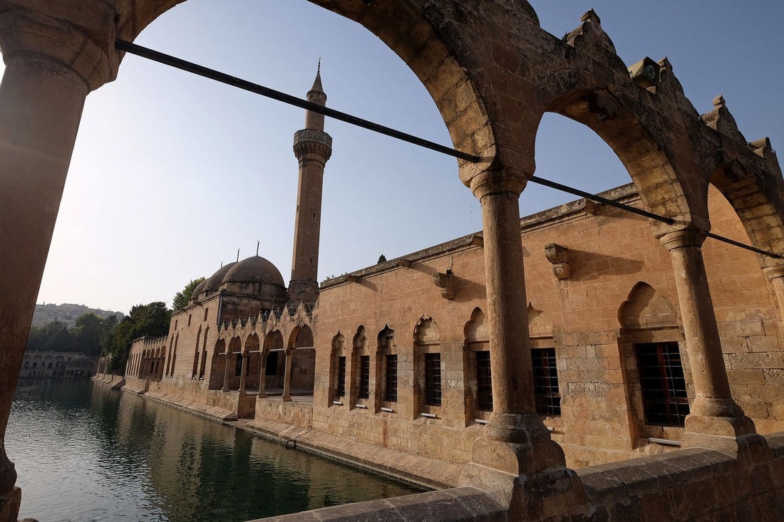
Rizvaniye Camii (Mosque) and Medresesi (School) in Sanliurfa.

T plus 126 - Southeastern Turkey (Mount Nemrut & Sanliurfa)

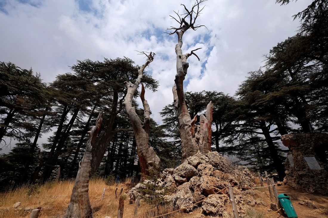
Yay!  The pretty pictures are back.

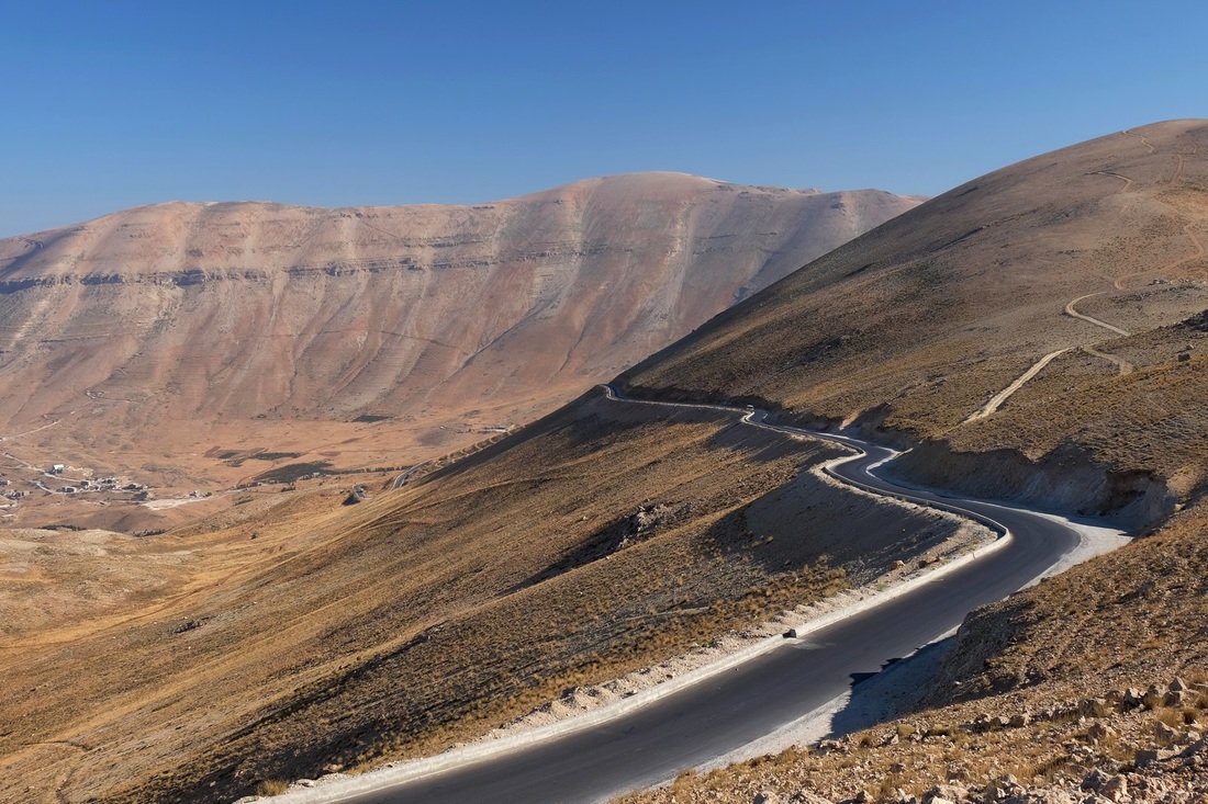
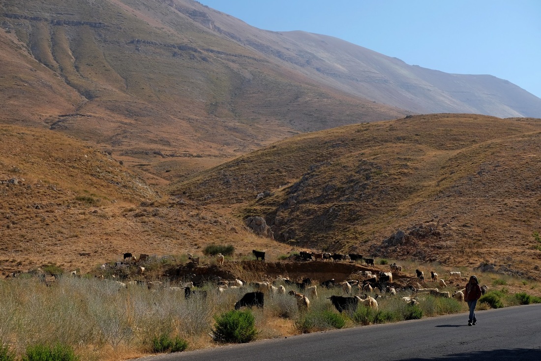
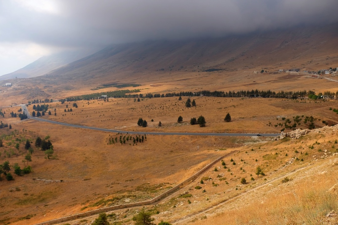
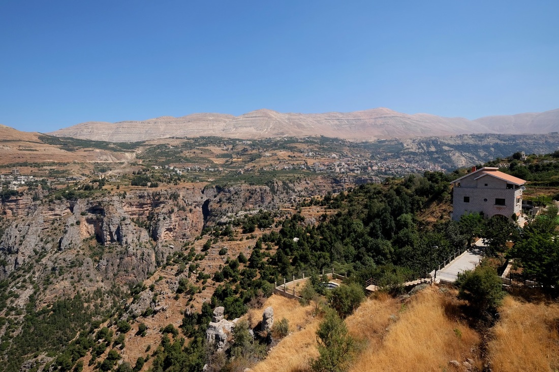
Following my earlier update, I've traveled from Trabzon on the coast of the Black Sea in the North to Mount Nemrut, somewhere in the middle, then onwards to Sanliurfa, which is in the Kurdish heartland of Turkey.  It's been a tough trip because there are very few direct buses and I had to spend a lot of time shuttling between transportation hubs i.e. bigger cities.  The nicest bits of this region, however, are in the smaller towns, and it takes some effort to get to them.

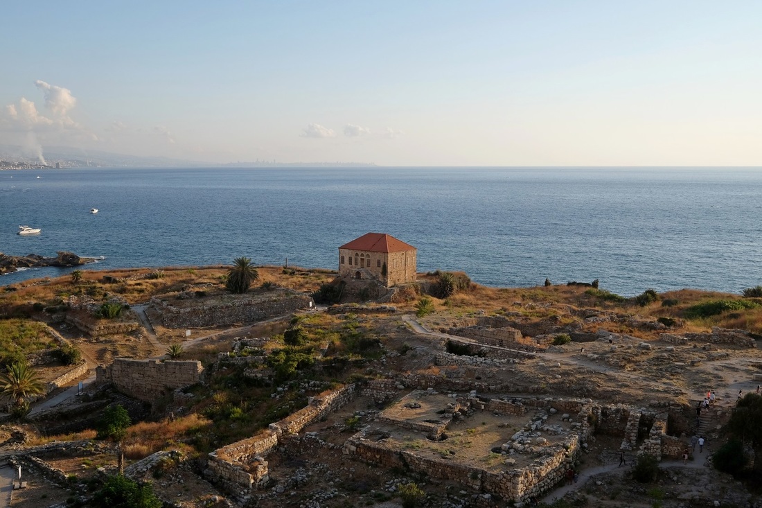
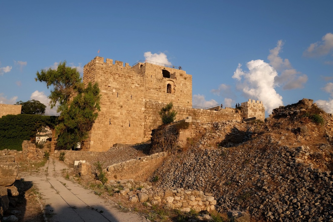
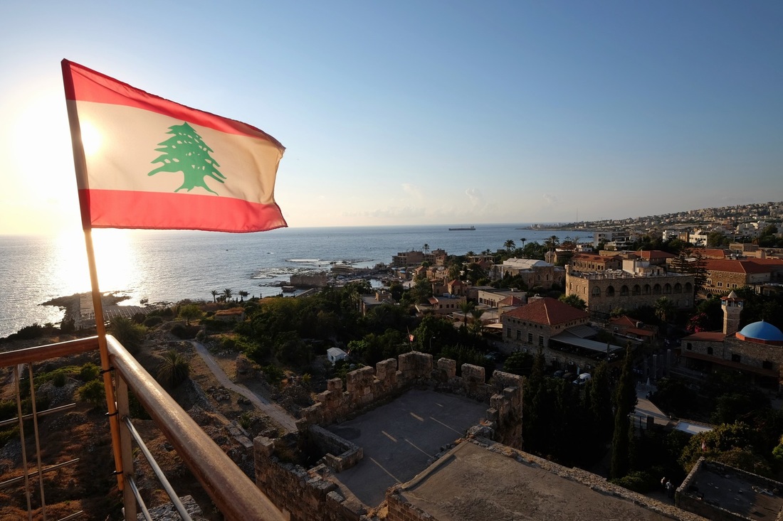
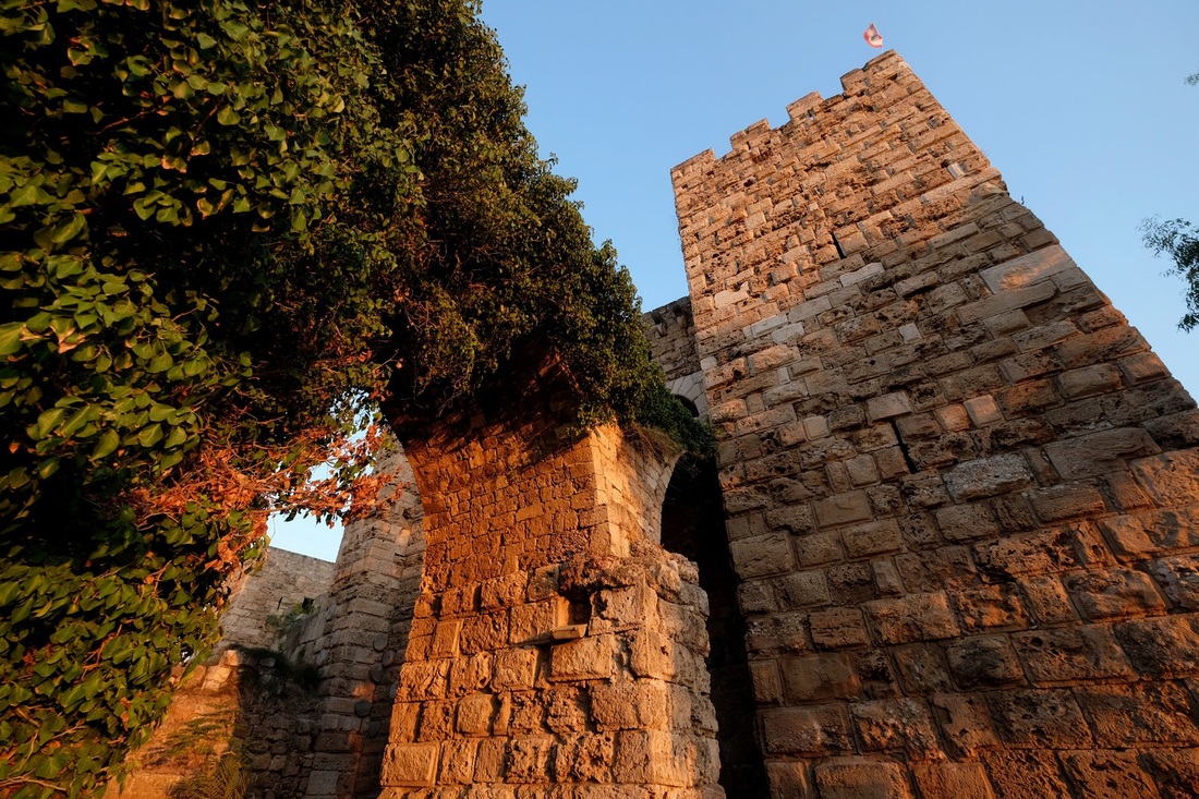
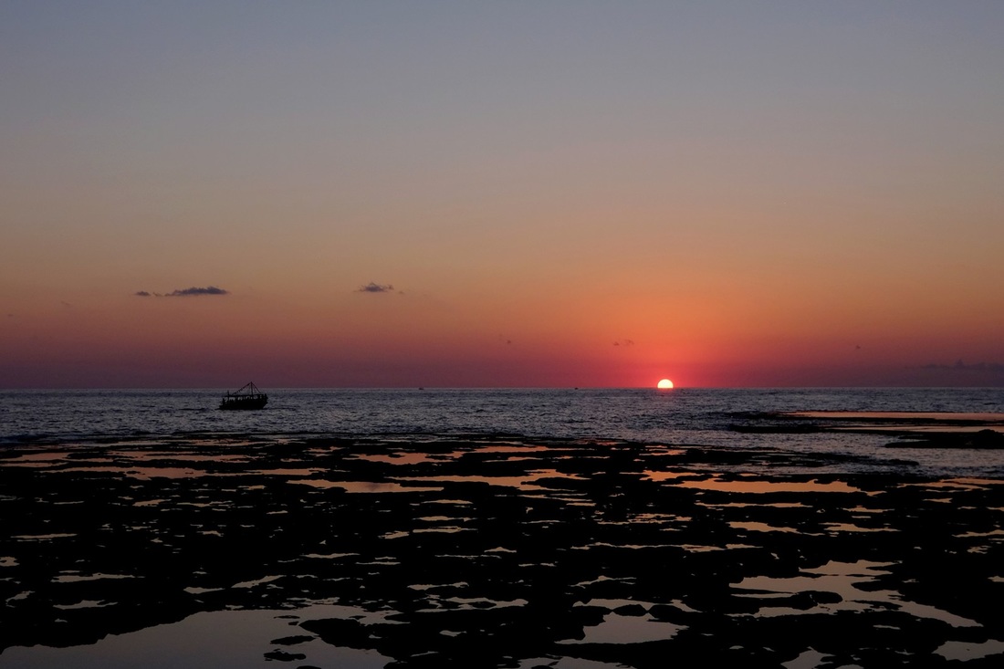
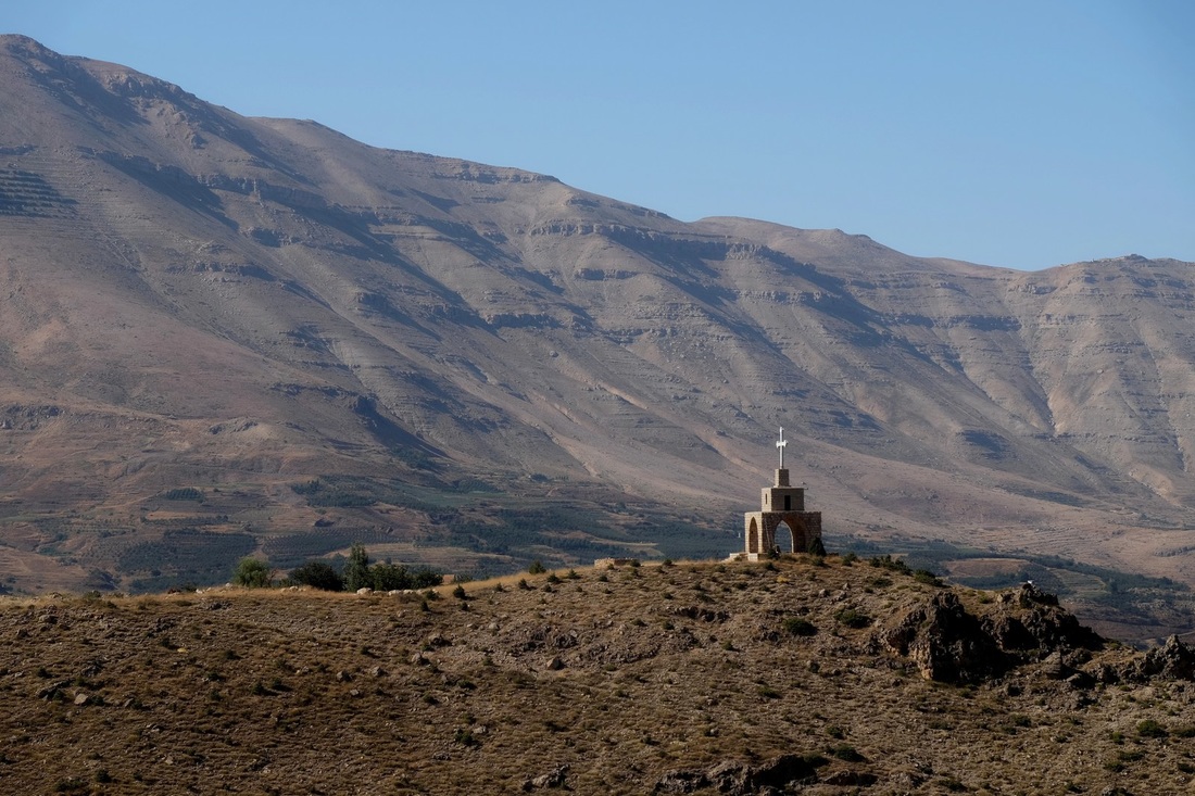
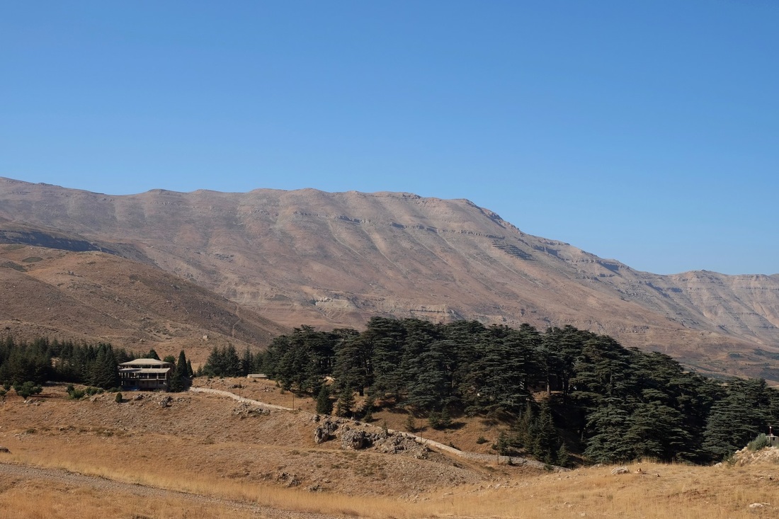
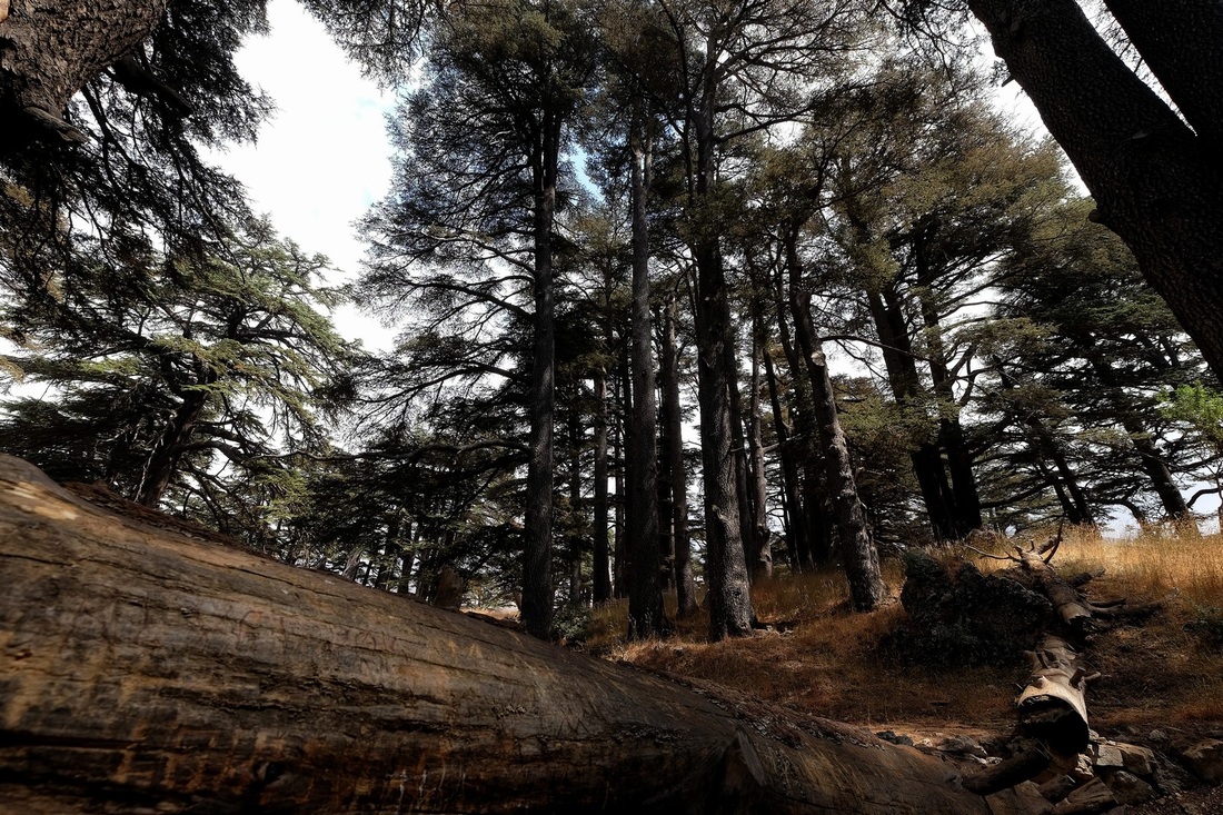
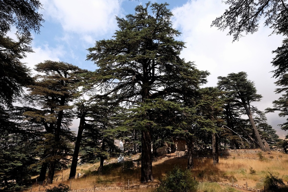
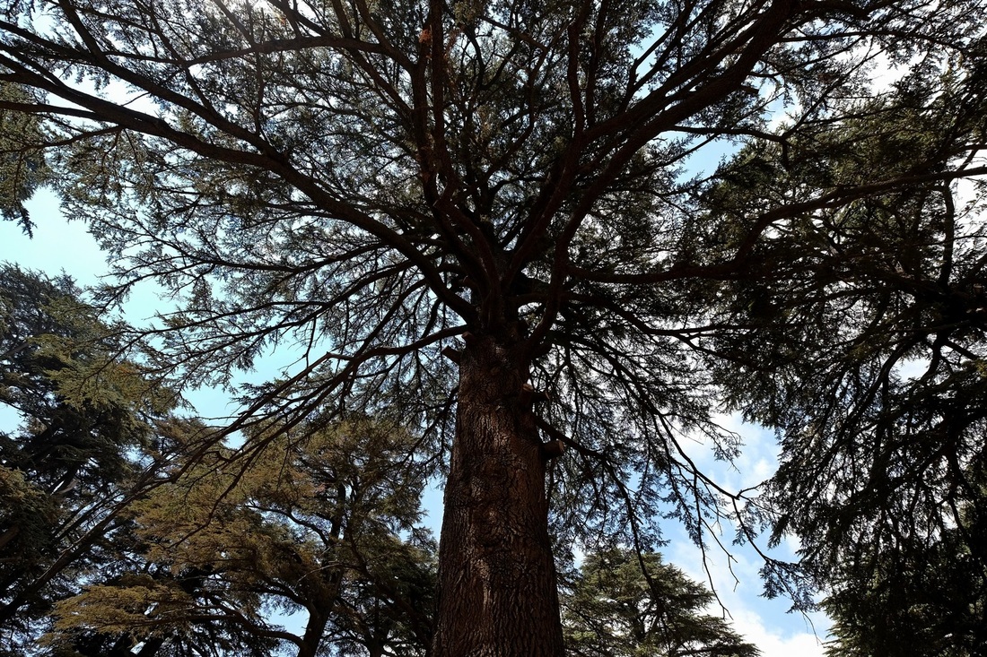
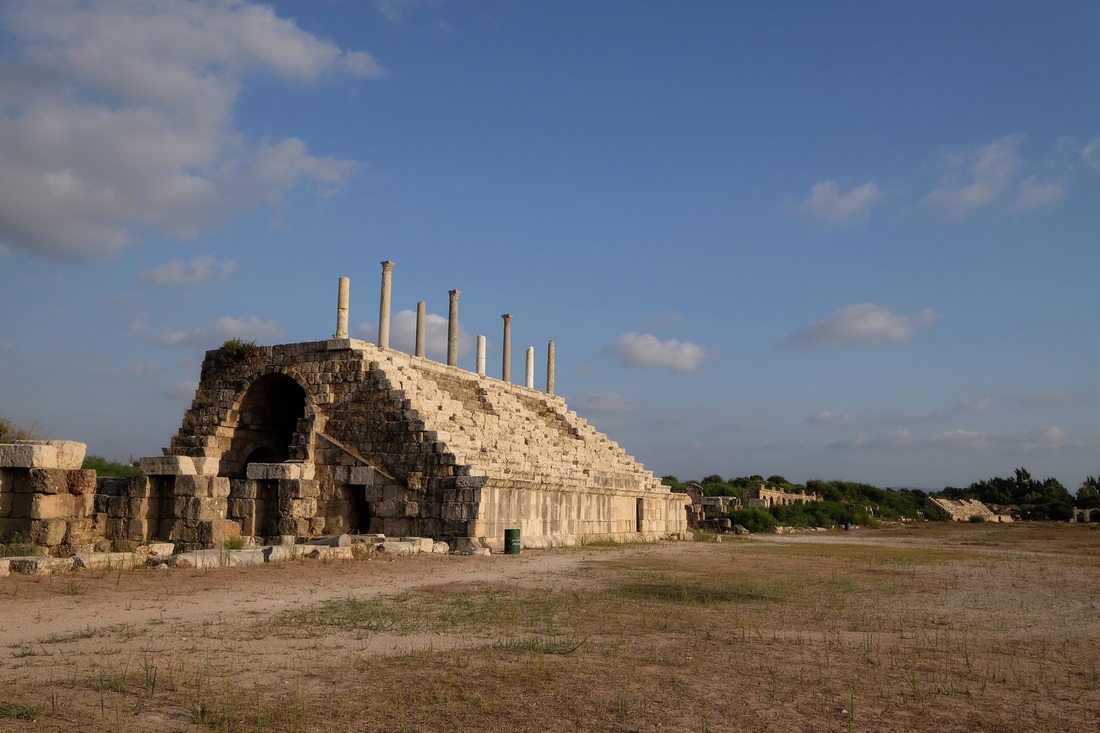
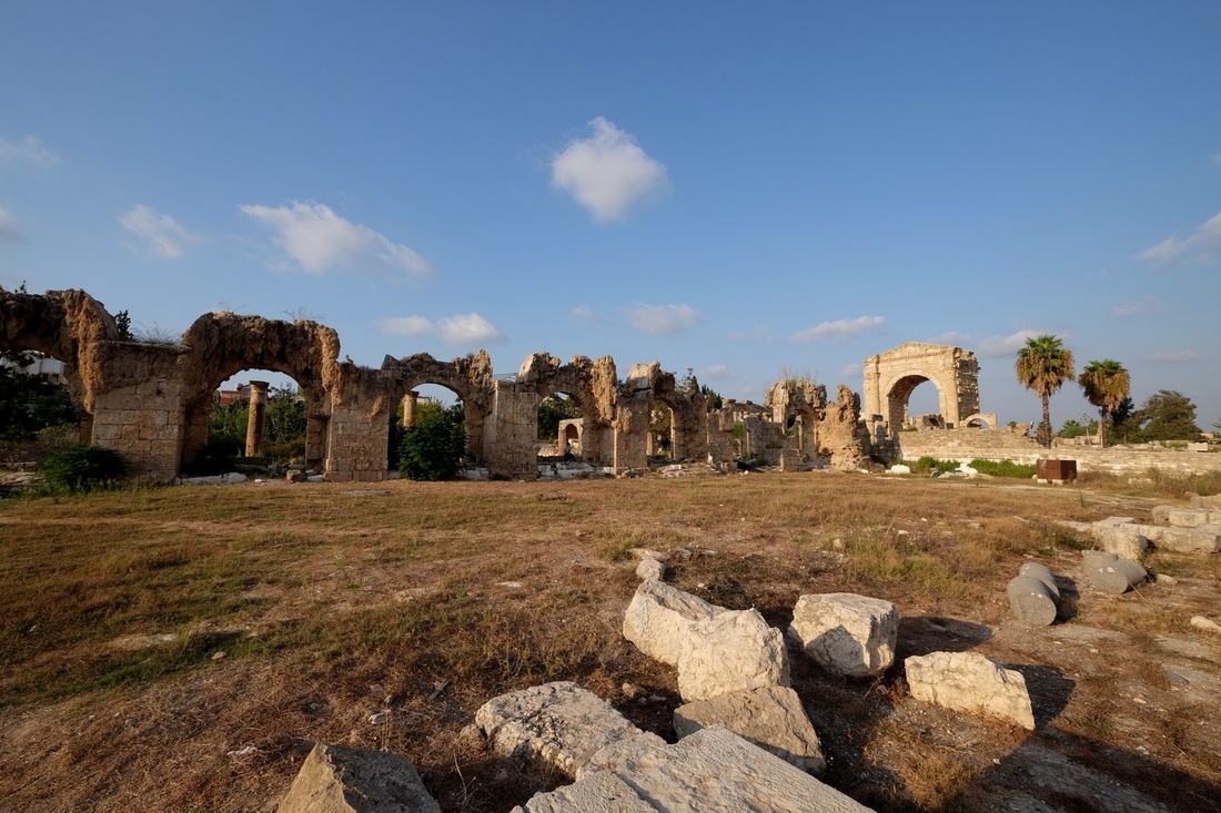
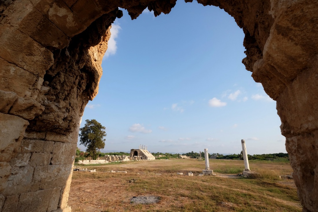
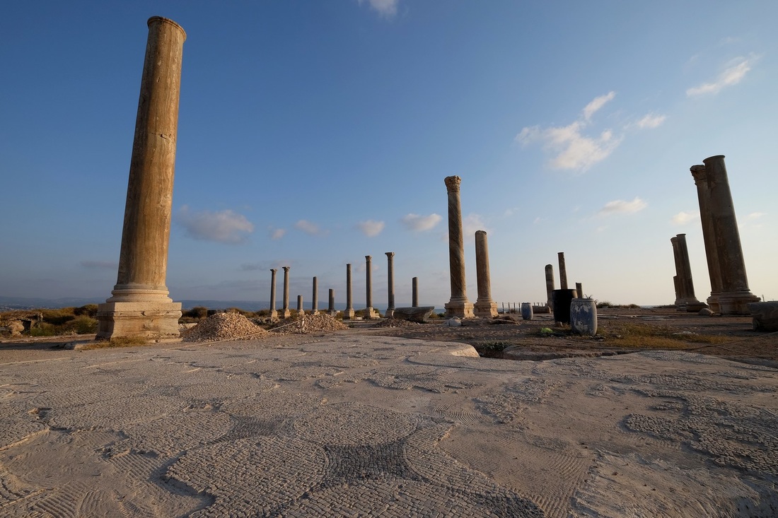
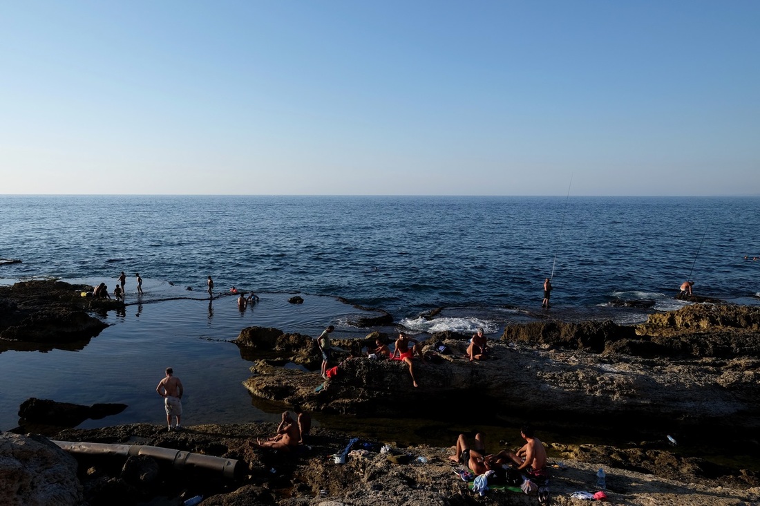
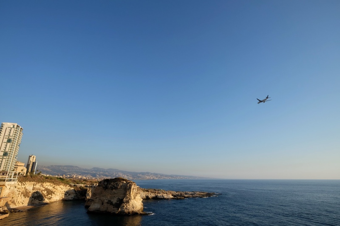
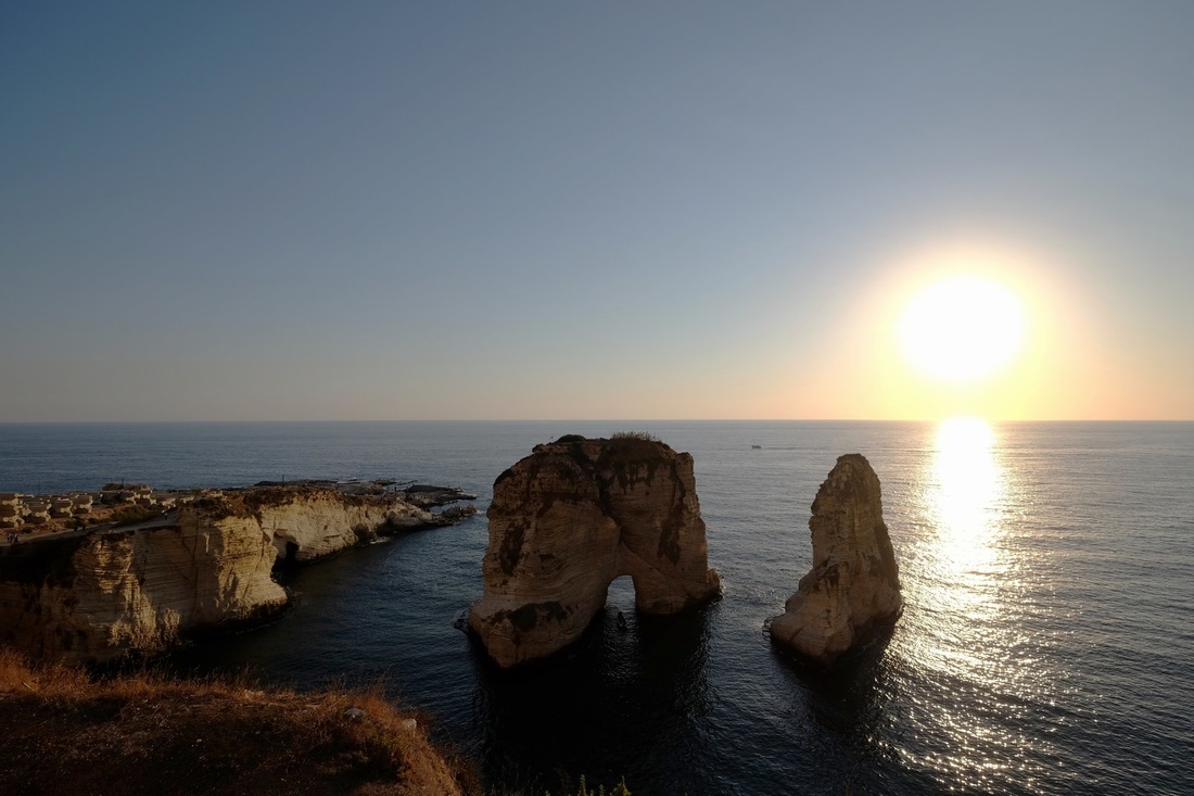
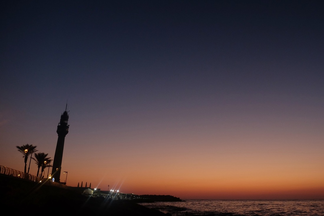
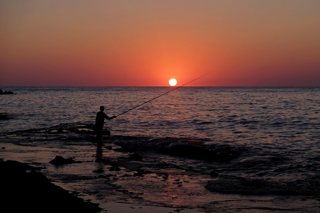
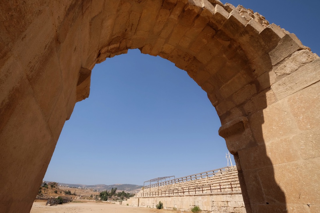
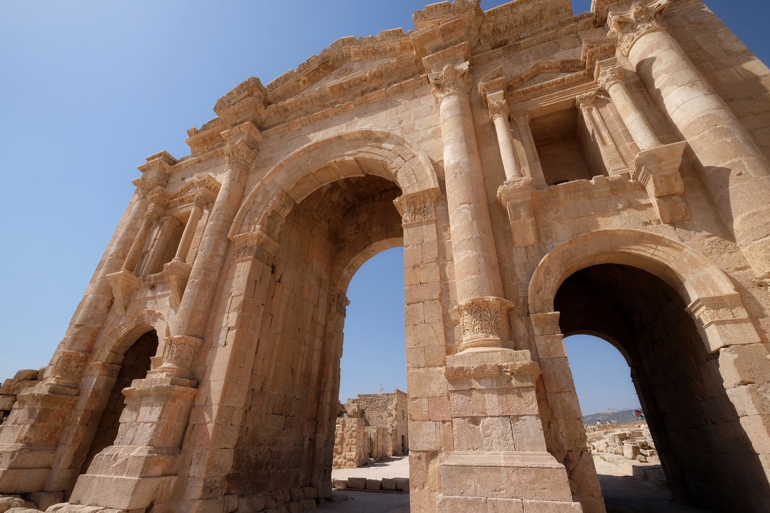
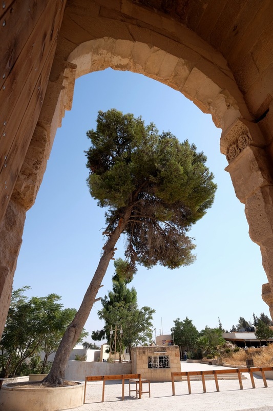
Some photos from my bus-ing around:

Picture
Picture
Picture
Picture
Jesus, that's pretty.

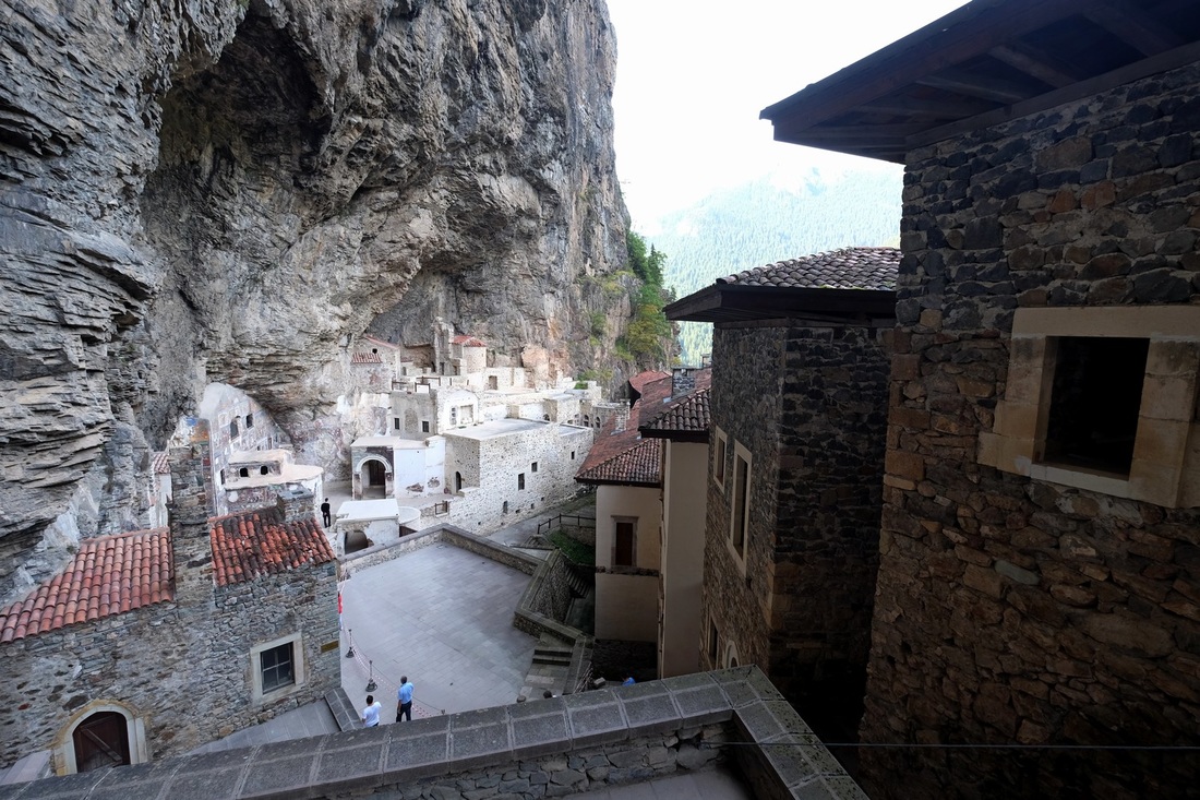
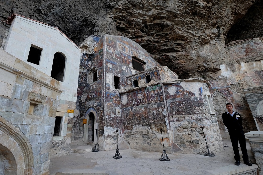
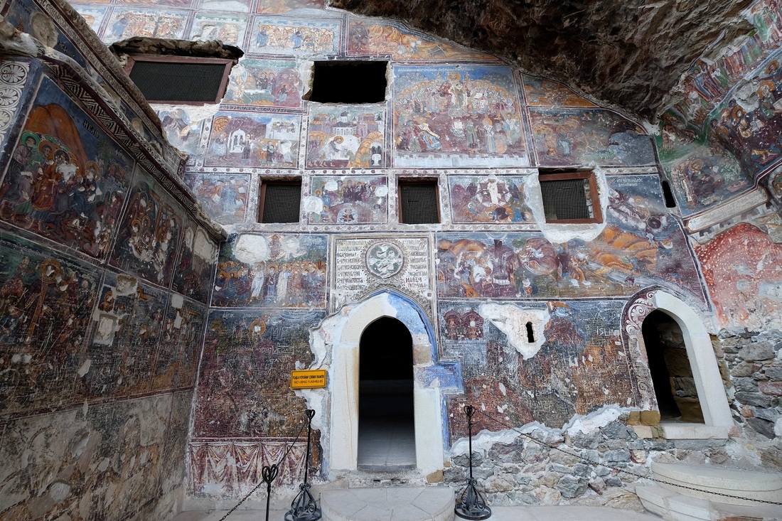
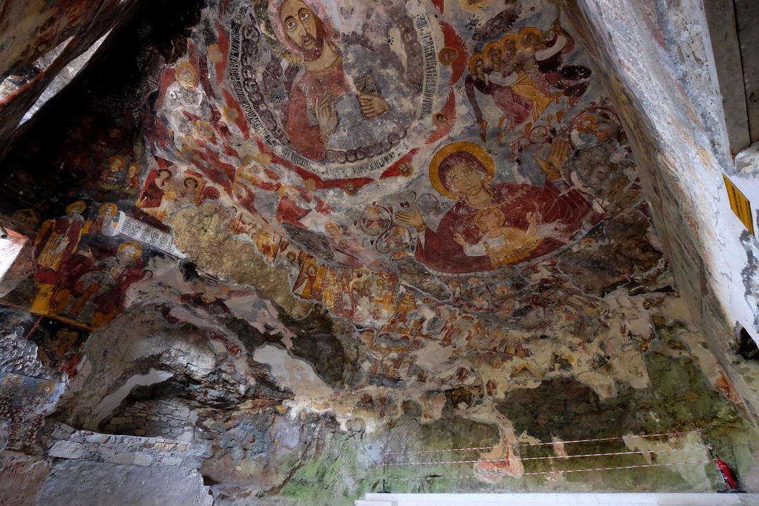
This is the Sumela Monastery, a Greek Orthodox structure dedicated to Christ and the Virgin Mary.  Yes, the guy at the very top of the bottom pic is Jesus, with a halo around his head.  The other frescoes depict biblical scenes and the colours used are truly stunning.  The monastery was founded in the 4th century but most of the frescoes were only added from the 15th to the 18th century.  The structure is carved right into the rock face on a cliff 1,200m high.  It's about 45km south of Trabzon, so it's not really in Southeast Turkey, but I thought I'd include it in this series because it's really very nice.

Picture
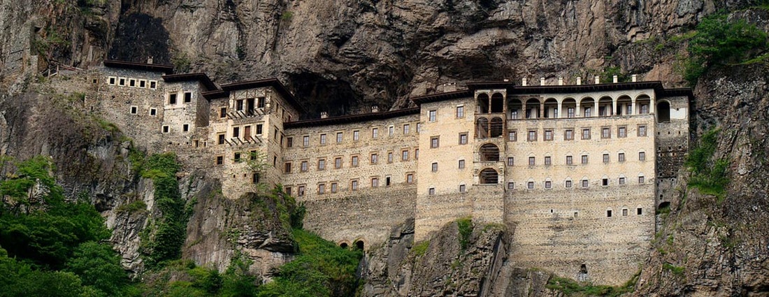
This is what the monastery looks like from the other side of the valley, which I didn't have time to get to.  Now I usually don't like posting photos which aren't mine, but this one really puts the monastery's cliff-face-location into context.  Photo from www.ancient-origins.net.

Picture
Picture
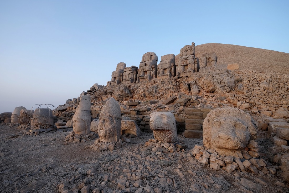
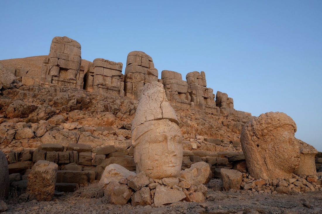
Mount Nemrut's temples and the colossal "beheaded" statues.  The history of this places goes way back to the 1st century BC when Antiochus, ruler of the Commagene Kingdom built these gigantic structures to honour, well, himself.  Over the centuries, the heads of the statues were separated from their bodies, but amazingly, both remain in excellent condition.  In the top pic (from the right), they are identified as Aslan (lion), Kartal (eagle), the three gods Heracles, Apollo and Zeus, the Goddess of Commagene, King Antiochus and another Kartal.  Clearly Antiochus saw himself as a god-king, fit to sit an an equal amongst the other gods of his era.  Sadly, his reign only lasted 26 years because he foolishly sided with the Parthians in their war with the Romans, and guess who won?

What is really fascinating is how the statues have Greek-styled facial features but clothing and hair from Armenian and Persian influences.  Some of the gods too, are dualistic in nature e.g. Zeus/Ahura Mazda (the Persian Zoroastrian omnipotent god), Apollo/Mithras (the Persian pre-Zoroastrian sun-god) and Heracles/Vahagn (the Armenian god of fire and war).  It's believed that Antiochus was trying to reconcile the different religions in his kingdom by combining influences from each.

The massive mound you see behind the statues is not naturally formed - it's a tomb complex constructed of rocks piled 50m high.

Picture
Picture
Picture
Picture
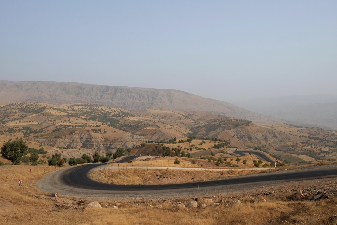
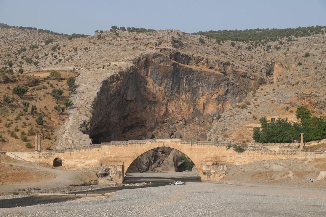
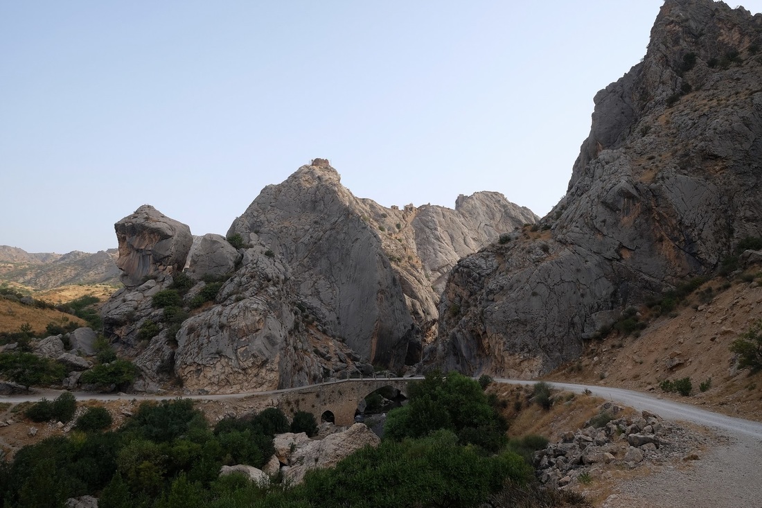
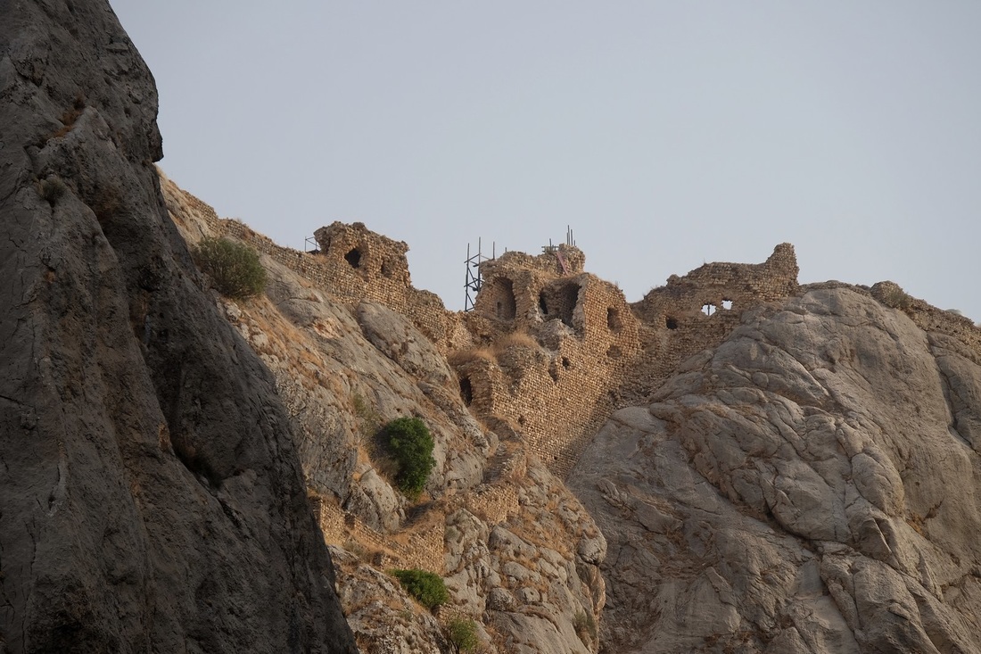
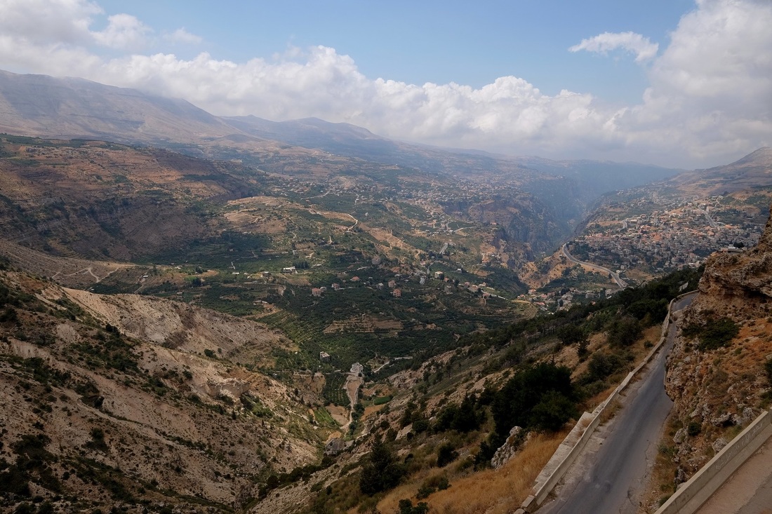
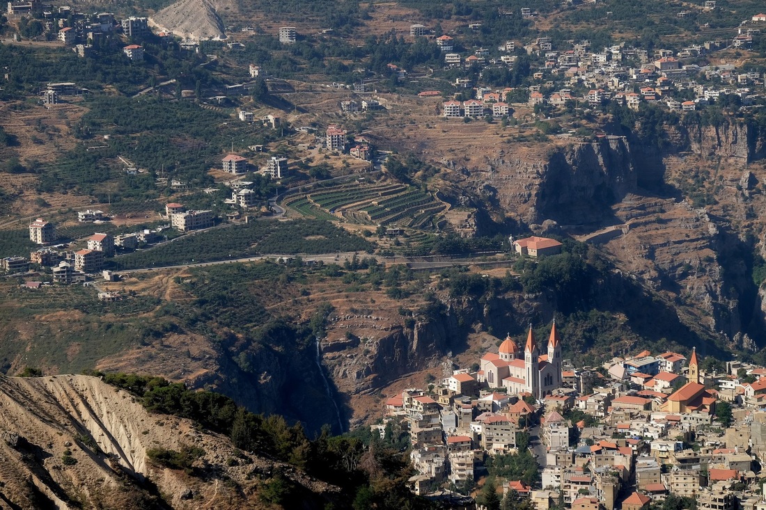
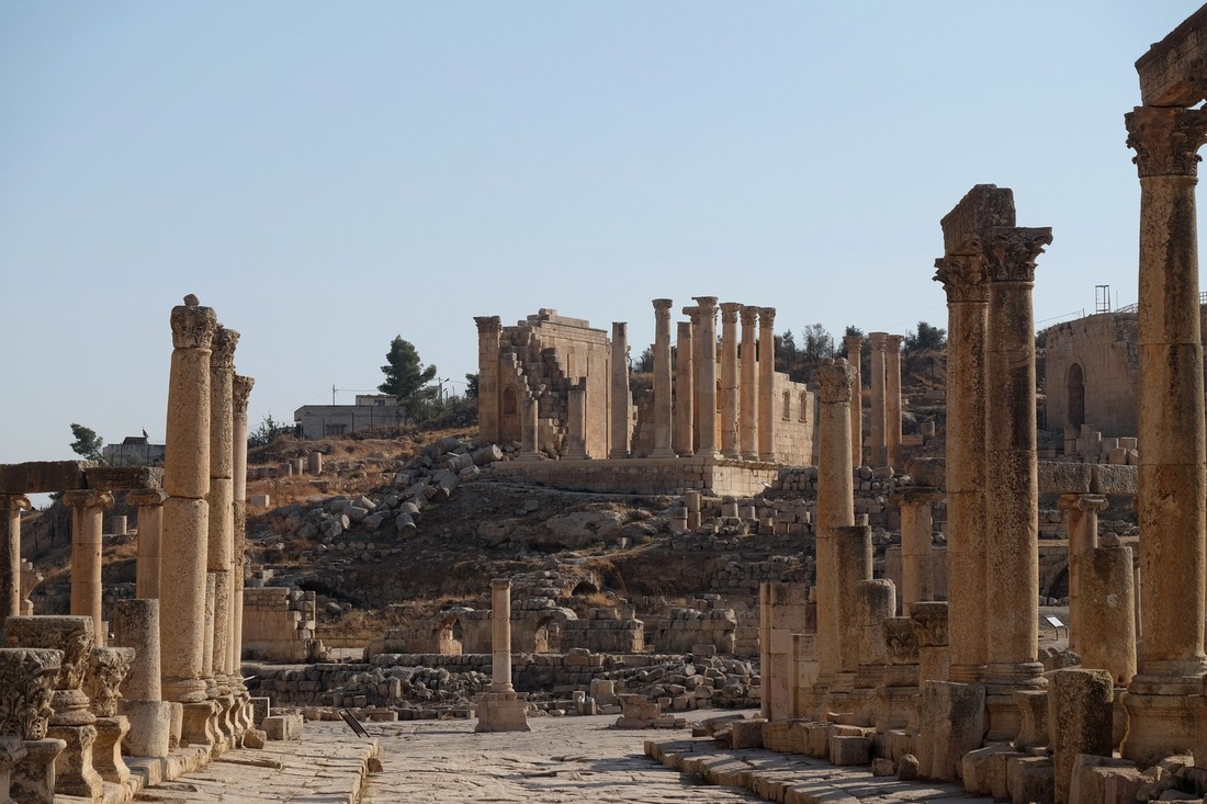
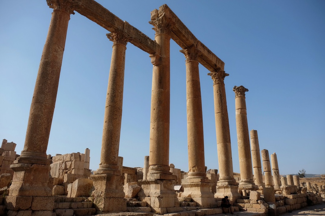
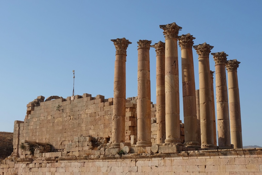
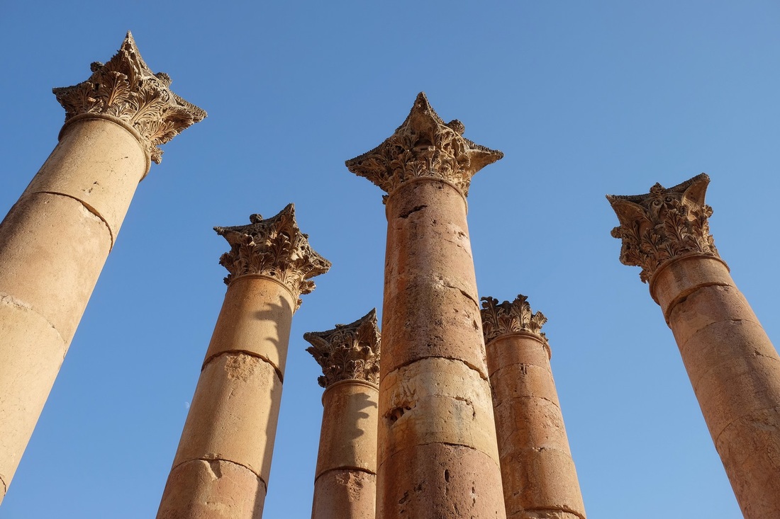
Mount Nemrut is located about 50km from the small town of Kahta and the drive there and back (top pic) is very scenic.  The second pic is of a Roman bridge built in the name of Emperor Septimius Severus in the 2nd century.  The last two pics are of the ruins of a 13th century Mamluk castle.  In the close-up (last pic), note how seamlessly the castle walls flow into the rock face.

Picture
Picture
Picture
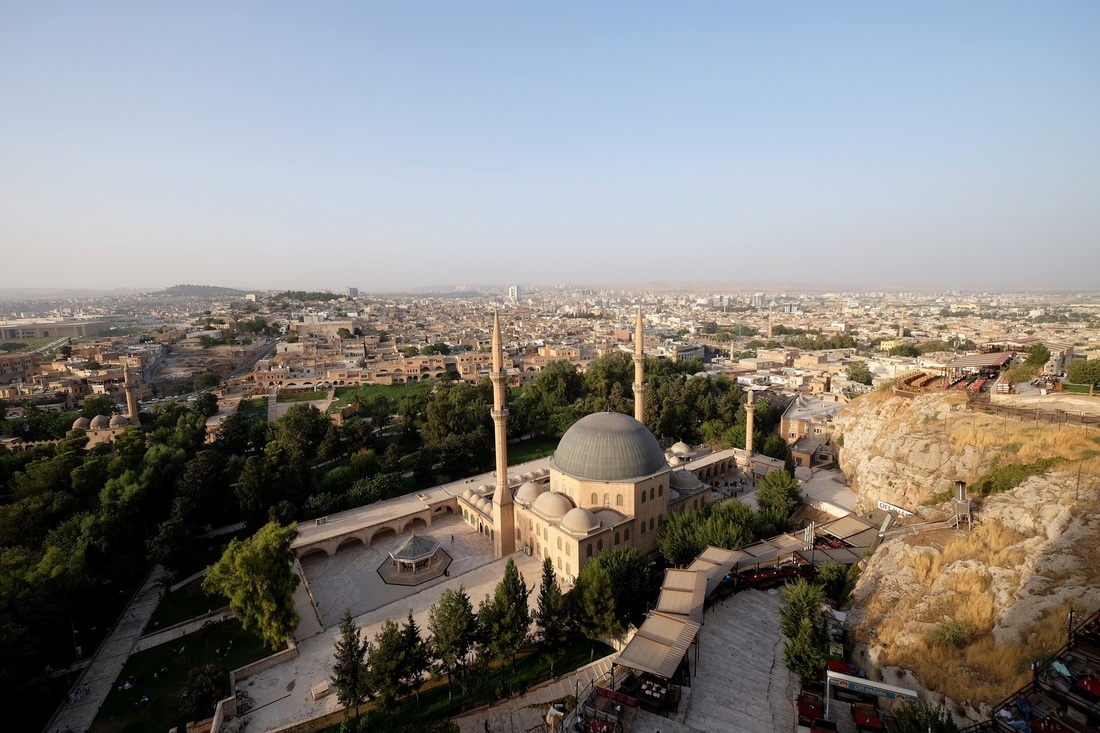
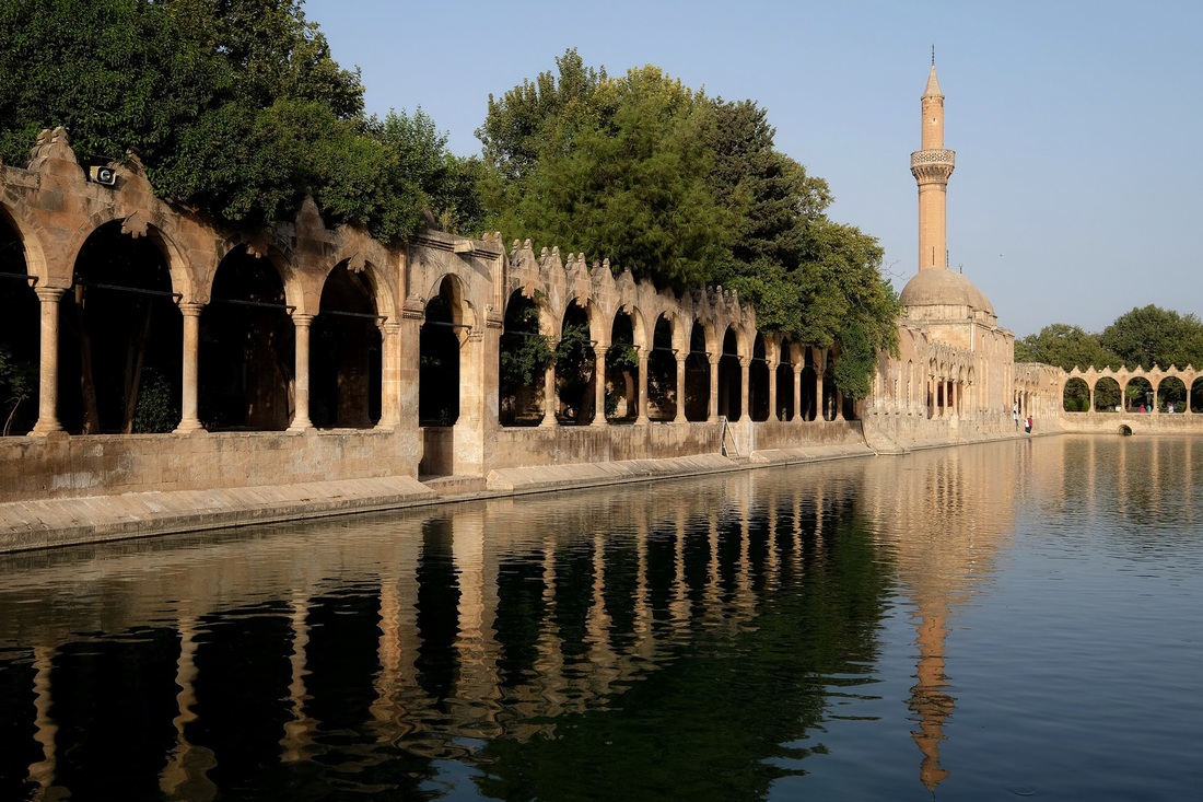
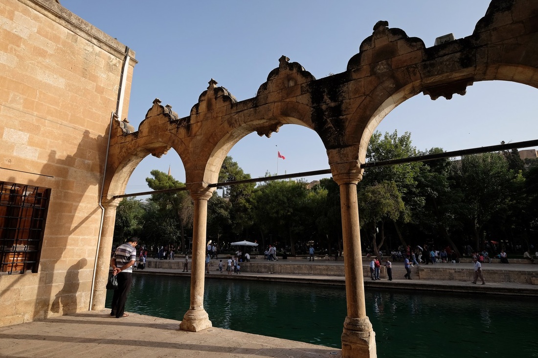
This is Sanliurfa (or "Urfa") - my favourite city in the Southeast (so far).  Also known as the "City of Prophets", Urfa is one of Turkey's most religiously-significant cities.  It is said that the prophet Ibrahim (Abraham) was condemned to burn on a stake here by Assyrian King Nimrod, but God turned the fire into water and the burning coals into fish.  A vast garden was constructed to symbolise this historical event and even today, people come from all over to pay homage and to feed the sacred carp which swim freely in the garden's waterways.

The top pic is a top-down view of Mevlid-i-Halil Mosque, and of the surrounding gardens and city.  The second and third pics are of Rizvaniye Mosque and its splendid waterfront arcade.  The third pic shows a man in prayer, facing the waters teaming with fish.

Picture
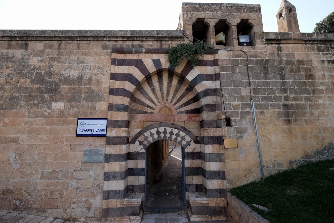
The beautiful entrance portal of the 13th century Rizvaniye Mosque and the interlocking black and white stones which give it such a striking appearance.  No, it is most definitely not paint!

Picture
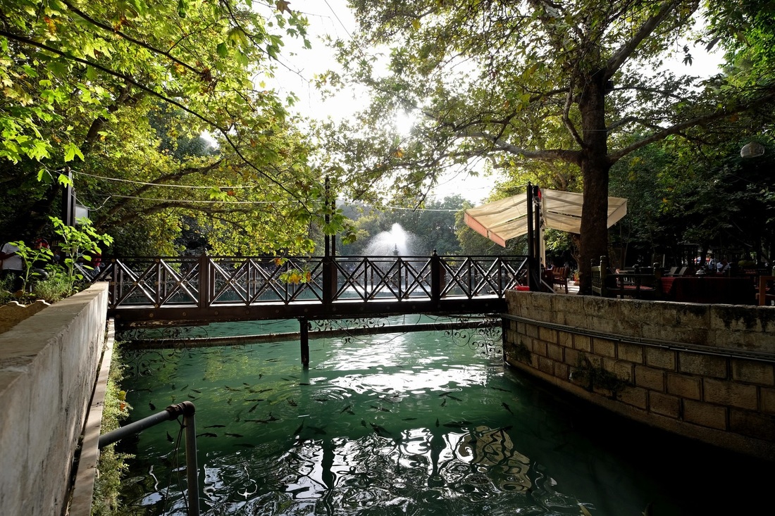
A little bridge across one of the garden's many waterways.  Here, you can really see the supposedly sacred carp. 

6 Comments

DOING MY BIT TO PROMOTE MY COUNTRY

14/9/2015

2 Comments

 
Picture
Picture
Ok, so these are NOT official adverts sanctioned by the Ministry of Tourism.  But I do think they need to start getting creative on how we can turn the "currency crisis" around in our favour.  Suggestions would be most helpful.

Photo credits:
Top:  Wikipedia
Bottom:  www.borneoadventure.com
2 Comments

TREADING LIGHTLY THROUGH TURKEY

12/9/2015

1 Comment

 
Picture
This is the Australian Foreign Affairs Office's latest travel warning map on Turkey.  My travel plans are superimposed on top.

The RED route is the journey I took from Northern Cyprus to Northern Turkey and back down again.  It's a pretty huge country - half of this route (Cyprus to Trabzon) took me 35 hours of continuous travel, first by ferry then followed by many buses.  

The BLUE route is where I'm going next, and this is a calculated risk, taking into consideration that military action against rebels in the area is focused beyond Turkish borders in Syria and Iraq (for now), or in worst case, within a 50km zone from within the Turkish border.

The GREEN route is my final leg and is the "tourist road" covering Capadoccia, Konya, Antalya, Ephesus, Pamukkale, Troy and Istanbul.


T plus 124 - Kahta, at the base of Mount Nemrut, Turkey (between the RED and BLUE dots)

Sincere apologies for the longer-than-usual hiatus.  I've been living in buses for the past week.  And it's not like there's that much to see in Northern Turkey, along the coast of the Black Sea, but I just wanted to get a feel of the non-touristy bits before heading into the more well-trodden paths.  The weather hasn't been co-operative either.  It's been drizzling for ages, with a monochrome cloud cover that does nothing for photographs.  Still, I visited an interesting monastery in Trabzon and I'll be heading to the famed Mount Nemrut to catch the sunrise at 3.30am tomorrow.  Hope to be able to post some nice pics soon.

So what's all this fuss about the demonstrations/protests/riots in Turkey that you may have seen on the news?  And why has Turkey gone on the offensive in striking rebel strongholds beyond its own borders in Syria and Iraq?  Finally, is it safe to visit at the moment?

To understand this, we need to first consider the position of the Kurdish people.  Before WW1, the Kurds were a nomadic people, living in the mountainous regions of present-day Southeastern Turkey, Northern Syria and Iraq and Western Iran.  After WW1, the Ottoman empire was broken up into different nation-states, but tragically not one for the Kurds.  In the following decades, they would face great oppression from the majority-led governments in most countries they settled in, including heinous acts of ethnic cleansing under the Saddam Hussein regime in Iraq.

Things have improved greatly since, but a large proportion of Kurds still hold out hope for an independent homeland - "Kurdistan" - an area covering portions of Turkey, Syria, Iraq and Iran.  They want this region to be "given back" to them.  In this regard, the Kurds in Iraq have been most successful and have established the semi-autonomous region of Iraqi Kurdistan after the collapse of the Saddam Hussein government.  Remember the first border I was bounced from?  In Iran, the Kurds have integrated relatively well into the society, forming about 10% of the population.  They only represent a tiny minority in Syria.  

It must be said, however, that the dream of a fully independent Kurdistan will likely never come to fruition because it means that the nations above have to give up chunks of land.  It's quite sad really, because it was the foreign powers i.e. the British and the French who split up the Middle East amongst themselves after WW1 and conveniently forgot about the Kurdish people.  Therein lies the profound sense of injustice which still simmers within the Kurdish people today.

It is the imperative to right this "wrong" that has underpinned the raison d'etre for groups like the PKK or Kurdish Workers Party (formed in 1978), which advocate armed struggle for independence.  The on-off military conflict between the Turkish government and the PKK has led to violence in the region, especially in the Kurdish areas along the borders which Turkey shares with Syria and Iraq.  A tentative truce was reached in 2013, with largely peaceful negotiations taking place after that.  

But this progress was abruptly shattered in July earlier this year when an Islamic State (IS) suicide bombing killed 33 (mostly Kurdish) people on the Turkish side of the border.  The PKK killed two Turkish policemen in apparent retaliation for the Turkish government not doing enough to combat IS.  The Turkish government responded with airstrikes on IS positions in Syria and PKK positions in Iraqi Kurdistan.  PKK has since initiated attacks in Turkey's Southeastern cities, claiming the lives of military personnel and civilians.

To make matters even more confusing, PKK has actually been a major opponent of IS in the region over the past few years.  So this Turkish Government - PKK - IS conflict will turn into a very ugly three-cornered fight.  The demonstrations we see in Turkish cities right now are largely led by Turkish nationalists i.e. anti-Kurdish movements.  And it doesn't help that a second round of general elections will be held in November 2015 after the July polls resulted in a hung parliament.  So the rhetoric from all sides has been fiery and the sentiments of the general population further inflamed.  

Finally, and most importantly, is it safe to visit Turkey right now?  My opinion is a qualified "yes".  The Turkish government values the tourism industry and its international reputation too much to allow a major outbreak of violence in the major tourist areas.  Yes, isolated incidents e.g. shootings and bombings can happen, and have happened recently.  But the chances of being in exactly the wrong place at exactly the wrong time are vanishingly small.  What about the Kurdish regions in the Southeast?  Well, I'd stay clear of the immediate vicinity of the borders between Turkey and Syria and Iraq for now.  But bear in mind that the vast majority of Kurds are amongst the warmest and most welcoming people you'd ever encounter.  So staying within the major cities in the Southeast should not be a problem.

Will update if the security situation changes.

1 Comment

CYPRUS - A FAILED ECONOMIC EXPERIMENT.  LESSONS FOR MALAYSIA?

7/9/2015

0 Comments

 
Picture
Protesters in Nicosia, Cyprus' capital in 2013 after the EU suggested that a portion of deposits of Cypriots be "taxed" i.e. taken away to help to pay for the bail-out that the country required.  Of course, Germany (and hence the Hitler treatment of Angela Merkel's photo) was the leading voice behind the suggested austerity measures.  Photo from The Times UK.

T plus 119 - Cyprus

I've just spent a couple of days in Cyprus, on route to Turkey.  And instead of posting pretty pictures, I thought I'd discuss the very interesting case of a little country with two economic systems.  How did this happen?  Well, the full history is rather convoluted, but the abridged version goes something like this:  

The Greeks rightly claim to have been Cyprus' indigenous inhabitants for thousands of years.  The island's position in the middle of the Mediterranean Sea has always held great commercial and military value; and in its long and turbulent history, Cyprus changed hands from the Mycenaeans (ancient Greeks) to the Persians, Romans, Arabs, Christian Crusaders, and the French.  The Turks arrived in numbers when the Ottomans took over in the 16th century, forming a minority community which remains till this day.  The British "liberated" Cyprus as an Ottoman economic backwater after WWI and granted it independence in 1960.

However, the Greek and Turkish communities never really got along and after a bloody period of armed conflict, it was finally decided by the UN in 1964 that Cyprus would be split in twain - the North for the Turkish community (37%) and the South for the Greek community (63%).  Note that there was no talk of separate sovereignty at the time.  It's actually remarkably similar to the Israel/Palestine situation which I wrote about earlier.  Turkey invaded in 1974 and in 1983 unilaterally declared northern Cyprus to be independent, under the made-up name of The Turkish Republic of Northern Cyprus; which no other country recognises except Turkey.  A period of instability followed, but south Cyprus i.e. the Republic of Cyprus was the one that gained greater economic prosperity in the following years, absent the economic sanctions levied on north Cyprus.  In 2004, the Republic of Cyprus became part of the EU and in 2008 it adopted the Euro as its official currency.

Bad move.

Firstly, the adoption of the EU's neo-liberal values resulted in expensive state-sponsored socio-economic development; which the state could not afford.  Second, the "liberalisation" of the banking sector (read: wanton over-development) led to a boom of easy credit fueled by deposits from Russian tax evaders.  Sunny place for shady money indeed.  Thirdly, it gave up all prospect of self-managed monetary policy, resulting it being shackled to the ball-and-chain that is the overvalued Euro.  It is unable to devalue its currency to regain its competitiveness.

Having visited both south Cyprus and north Cyprus, I compared what I saw at both ends of the island and things are looking bleak for the supposedly more prosperous, better-managed South.  The introduction of state-subsidised services e.g. in public transport has robbed the south of any entrepreneurship in this area.  I had to wait an hour for an inter-city bus, with air con and seat belts of course, to make its scheduled stop.  In the north, a rickety tin can driven by a toothless man roared up within 10 minutes.  The euro, and the artificially high cost of living it imposes means that the south charges 50% more for every can of coke (EUR1.00) and twice as much for a meal (EUR10) than its northern neighbour.  Hotel rooms too, cost 50% more in the south.

Why then, wouldn't tourists just go straight to the north?  The beaches are the same; the medieval city-scapes are the same; and the Mediterranean climate is the same.  And guess what, they're beginning to realise this.  More bad news for the south then.  From what I can see from the port cities of Girnes (north) and Limassol (south), the former is a bustling hive of activity while the latter is a ghost town haunted with shuttered shops and empty restaurants with sulky staff - the mimes of napkin-folding despair.

And if I'm being honest, the country needs to realise that it doesn't offer anything unique for tourists, vs its Mediterranean contemporaries.  The beaches in Turkey or Lebanon are as good if not better.  The clubbing/party scene in Beirut is light years ahead.  The ancient monuments in any country within close proximity eclipse Cyprus' own in terms of scale and historical value.  Given this scenario, the country must offer itself at a discount to its peers, not at a premium!  And yet, it has the 8th highest minimum wage in the 27-member Euro area.  For a country that relies on tourism as its most significant income-earner, it has just priced itself out of the competition.  How crazy is that?

Ok, so how is this related to Malaysia?

Well, Cyprus' north-south divide and the contrast in their present-day competitiveness got me thinking about the "currency crisis" which Malaysia is facing today.  The Ringgit has fallen about 20% from its previous steady state against the USD and people are panicking like its the end of the world.  Is it?  I'm not so sure.  Is a weak Ringgit bad at this point in time?  Let's examine the pros and cons.

Negatives:  We feel poorer when visiting other countries.  There is a risk of inflation.  Businesses which import (and most SMEs are net importers) face higher costs.  These are very real issues, make no mistake.

Positives:  Exporters suddenly have a 20% price advantage.  Tourists suddenly find our country 20% cheaper.  Foreign investors suddenly realise that operating costs have come down by 20%.

Now, Malaysia is the world's 18th largest net-exporter.  In other words, we're an export-driven economy.  With global demand low and supply-side competition high, a price advantage is not a bad thing right now.  It's the same for tourism - yes, Thailand has better beaches and Singapore has better shopping.  But when tourists do the math, I'm betting that many will lean towards the more conservative side of the cost-benefit equation.  Remember that their own disposable incomes have taken a hit in recent years too.  And as for FDI e.g. in manufacturing, a double digit cost saving in a global paradigm of single digit margins makes a lot of sense.  Yes, we've lost a lot of portfolio i.e. investment flows, but between hot money and money that is here-to-stay, I know which I'd prefer.

What about the "suffering" that Malaysians have to endure from this disgraceful devaluation?  Well, first, let's put pride aside.  We are too fixated on "1998" and "3.80".  We need to drop these two concepts because they are meaningless today.  We live in new times, with new challenges ahead of us.  The more important question is, will there be hyperinflation?  I don't think so.  The majority of middle-class income is spent on servicing bank loans, which isn't affected at all, and the purchase of essential household items e.g. petrol, food etc.  Most of these are price-controlled.  Sure, we'll have to cut back on a few luxury items, but will that kill us?  Our holidays abroad will be shortened from 10 days to 8 days.  But it's no major sacrifice, really.

What concerns me more is the fate of our small businesses which import their raw material and sell locally.  Their margins will be undoubtedly squeezed.  And they employ 80% of the working population.  But I argue that the devaluation of the Ringgit (fortunately) coincides with a multi-year low in commodity prices.  Simple example:  The chicken farmer pays 20% more for chicken feed, his highest variable cost; BUT it's still less than what he paid two years ago.  Has the selling price of his chickens gone down?  No.  Can he survive this?  I think yes.  It's largely the same story for steel for developers and fertilizer for plantation owners, and so on.  And I further argue that businesses in Malaysia are due for a round of cost-optimisation anyway, which will ultimately benefit them and the country in the long-run.

The much bigger problem is the uncertainty surrounding the drop.  Businesses can cope with a drop; what they cannot cope with is not knowing how much further it will drop.  In stabilising the Ringgit our policy-makers need to make some hard choices.  They face what is known as the "Trilemma" i.e. an impossible trinity of policy positions which cannot occur simultaneously:

1.  Stable exchange rate (which is what our businesses want)
2.  Free capital flow (which is what the foreign investors want)
3.  Stable interest rates (which is what the general population wants)

I think the market assumes that the Central Bank won't touch #3 because it would mean higher borrowing costs for consumers.  So it is perhaps fearing the clamp-down on #2 which is exacerbating the problem.  Plus of course certain political scandals, and the RMB devaluation aren't helping.  But why shouldn't we touch #3?  The Central Bank has only revised rates once, by 0.25% since May 2011.  Central banks e.g. Denmark, Jordan which openly declare a currency peg or a managed float i.e. fixing #1 allow #3 to be (more or less) market-driven.  Then they use foreign exchange reserves to mop up the difference.  We seem to be hesitant in liberalising the former, and rapidly depleting the latter - reserves have dropped to USD95 bil from USD130 bil a year ago.

A revision in interest rates, even a small one, may signal to the markets that the Central Bank is ready to compromise on #3 and not resort to restricting #2.  If we are confident that the country's fundamentals are strong, the impending US Fed hike is priced-in, and the Ringgit is intrinsically undervalued, the interest rates wouldn't move much at all.  And it wouldn't affect the people a much as you'd think.  The majority of people will have the option of extending the tenures on their loans rather than paying more monthly.  And if the Government is really so concerned about a public outcry, a small reduction in GST could be seen as fair trade.

Let me be clear, I'm not advocating a peg to USD.  But if the market is not confident about #2, and we won't move on #3, then the only variable which will move is #1.  And presently it is moving in the wrong direction.
0 Comments

BETTER LAYOUT?

4/9/2015

2 Comments

 
I've removed the sidebar on the main blog, giving more prominence to the photos which now will load full-screen.  I think it's better this way.  Thanks SC for the suggestion!

SMALL UPDATE:  I'm headed to Cyprus on a late flight this evening, then to southern Turkey via ferry.  
2 Comments

TAKING THE LONG WAY ROUND IN LEBANON

1/9/2015

12 Comments

 
Picture
The idyllic coastal city of Byblos where ancient Roman Ruins lie scattered close to the shoreline.

T plus 114 - Lebanon

This has got to be the perfect country to take a drive in.  Lebanon is only about 200km long and 50km wide.  And it is blessed with over 220km of gorgeous Mediterranean coastline to the West, and a gently sloping mountain range to the East.  So I abandoned my long-standing principle of sticking to public transport and splashed out for a car for three days.  It wasn't as expensive as I thought it would be - the car was only USD29 a day, for a brand new Kia Rio, and petrol's about USD 0.80 per litre.

I took the coastal road from Beirut to Tripoli in the North, stopping by the natural phenomenon of Jeita Grotto and the ancient Phoenician-Greek-Roman city of Byblos.  Then I turned inland, towards the mountains where I wound my way through the Garden-of-Eden-esque Qadisha Valley, ending up in Baalbek which is home to the remains of the monumental Temple of Jupiter from the Roman era.  On the last day I drove right across the country to the Hezbollah stronghold in the South where a combination of refugee camps and Roman constructions co-exist side-by-side.

At no point did I feel unsafe, even though there's a long-standing perception that some parts of Lebanon are "no-go" areas.  The reality is that there are enough troops stationed across numerous checkpoints in these areas to halt a medium-scale invasion.  Add to this the reassuring presence of 10,000 United Nations Interim Force troops stationed in South Lebanon (UNIFIL) and you've got yourself a pretty secure situation.  As secure as an area hosting the game of military brinkmanship played by Israel and Hezbollah can be I suppose.  

Some photos from my drive-abouts:
Picture
Picture
The truly staggering stalactites and stalagmites of the limestone caves of Jeita. The calcite formations here grow at a rate of 1cm every 100 years, so the history of this place goes all the way back to the last Ice Age, 3 million ages ago!  Stalagmites are formed when drops of bicarbonate-rich water drip down onto a surface, depositing microscopic layers of calcite which build up over millions of years.  Stalactites form on the "ceiling" directly above the stalagmite, also from the same chemical mechanism, so they are usually found in pairs.

The terms "stalacite" and "stalagmite" are based on the Greek word "stalassein" which means "to drip".  The chemical explanation is quite straightforward:  water comes into contact with the calcium carbonate (calcite) found in rocks;  the calcium carbonate dissolves in the water along with atmospheric carbon dioxide, forming calcium bicarbonate.  Some of the calcium carbonate precipitates out, forming deposits on the surface which the water drips onto.  The chemical equation is H2O + CO2 + CaCO3 = CaH(CO3)2.

You really have to forgive the appalling quality of the photos here.  Absolutely no photography allowed and they enforce this with military levels of rigour.  
Picture
Here's a proper photo from this website where there are more to be marveled at.  
Better still, visit for yourself!

Picture
Picture
Picture
Picture
Picture
Byblos:  the view of ancient Roman ruins from 2nd and 3rd centuries BC (top 2 pics) from the Crusader Castle built in the 12th century.  There's not much left of the Roman-era buildings, but the seaside location is nothing short of spectacular.  Before the Romans, this city was ruled by the Greeks.  

And way before the Greeks, it was inhabited by the Phoenicians who developed the foundations of the Roman alphabet we use today.  They were also a great sea-faring nation and some say their boats reached the shores of America 2,000 years before Christopher Columbus! 

Picture
Sunset from the fishing harbour of Byblos.  Today the boats carry more tourists than fish.

Picture
Picture
Picture
Picture
Picture
Picture
Picture
This was the roadtrip's real highlight for me - the epic beauty of Lebanon's mountain range.  The top two pics are of the Qadisha Valley and the charming Maronite Christian town of Bcharre.

Picture
Picture
Picture
Picture
Picture
Picture
Along the way you can check out the cedar trees at the Bcherri Grove, one of the few remaining collections of Lebanon's most famous tree.  Yes, this is the same tree on their flag (see pic in Byblos series for sample).  One reason for their scarcity is the tree's lengthy growth cycle which is hundreds of years long.  Some of the trees at Bcherri are over a thousand years old.  The bottom pic is of the inside of a hollowed-out tree.

Picture
Picture
Picture
Picture
Picture
The famed Roman Ruins of Baalbek.  The top two pics are of the six remaining columns (out of 54 originally) of the Temple of Jupiter (the largest Roman temple ever built) and the third and fourth pics are of the Temple of Bacchus (the world's best-preserved Roman temple); although it was later discovered that the temple was actually dedicated to Venus, not Bacchus.  

It's hard to describe how monumentally large these structures are.  For a frame of reference, see if you can spot the red van in the bottom pic.  Basically each of the building blocks is as large as a car.  The columns of these structures are 20m tall, and the blocks which go on top of them weigh 60 tonnes each.

Picture
Night shot of the entire complex at Baalbek.  It's pretty massive.  You can just about spot the 6 columns of the Temple of Jupiter in the rear.

Picture
Picture
Picture
The Hippodrome of Tyre, in the south of Lebanon.  The rectangular arena sat 20,000 spectators and was used for games like chariot racing.  This is the largest and best-preserved Roman hippodrome in the world.  Although I suppose "best preserved" is a bit of an over-sell seeing as how much of it has disappeared since it was built in the second century.

The bottom pic is taken from one of its entrance portals.  Only two sets of stands remain in decent condition.  The first is clearly visible in the centre of the frame.  The second set is far away in the distance, illustrating how large the arena is.

Picture
Picture
Picture
The Roman mosaic street of Al-Mina in Tyre, south of Lebanon.  It's amazing how much of the mosaic has survived after 2,000 years.  The (green) columns are said to have been imported all the way from Greece, a pretty hardcore journey back in the day.  

Are they green?  I can't tell - most of you know about my issue with colours.

Picture
The ubiquitous UNIFIL troops stationed in the south of Lebanon.  
Just to reassure everyone that it's pretty safe here.

12 Comments

BEIRUT – THE MIAMI BEACH OF THE MIDDLE EAST

30/8/2015

0 Comments

 
Picture
The Beirut waterfront at dawn (5.30am), overlooking the Mediterranean Sea.  
Yes, this is still the Middle East.

T plus 112 - Beirut, Lebanon

It’s 2.30am.  I had just extricated myself from the cheapest hotel I could find in Beirut.  Sometimes things are cut-price for a reason.  Or in the case of this hotel, several reasons.  First, there was the “present” waiting for me in the toilet bowl, then there’s the complete absence of any amenities – no Internet, no hot water, and the electricity cut in and out as though we were still living through one of Lebanon’s many wars.  But the one which really triggered the late-night evacuation was the cockroach infestation which had made its way into my backpack and god knows where else.

So I left Hotel Fear Factor, deciding that I was better off on the streets.  It happened to be a Thursday night i.e. party night (the “weekend” here is Friday and Saturday).  So I got to check out Beirut’s legendary nightlife.  You hear it before you see it – a mishmash of throbbing beats vibrate the air from afar, and as you’re drawn closer, you discover that it’s actually rather good.  Almost every bar has its own deejay spinning proprietary versions of the latest music from the West.  Girls in barely-there clothes strut about on their stilts-for-shoes.  Guys stagger out of shiny clubs into shinier supercars retrieved by valets.  I saw one attempt a few donuts in his Maserati outside the club before tearing off in a V8 induced sonic boom. 

Wait a second.  Am I still in the Middle East?  I settled down for the night, on a bench on the waterfront, wondering if the magic pumpkin of hedonism would deflate at the break of dawn.  It didn’t.  I was awakened by the dampened footfalls of joggers in branded footwear, with matching dri-fit attire.  I sat there for a while longer, absorbing the stunning sunrise over the Mediterranean Sea.  Bronzed blondes in hot pants jiggle by, followed by six-packed men with golden retrievers in tow.  They pound the same pavement as hejab-ed women in baggy clothes.  No one skips a beat.  Divergent cultures seem to have found common ground in a shared desire to keep trim and look good.

Later on, I peruse the shops while searching for new accommodation.  Beirut feels like a prosperous European city where elegant wood panelled stores stock anything from Hermes to Harry Winston to Harley Davidson.  Unfortunately for the thrifty traveller, the cost of living here is pretty European too.  A medium Big Mac meal from McDonalds is 10,000 Lira, or about USD6.60.  A decent dinner at a simple restaurant is twice that, and it seems like people here dine out often.  Surprised?  Don’t be.  Lebanon’s GDP per capita is far ahead of its neighbours in the Middle East and is closing in on countries like Turkey.  Monthly salaries in the country averaged at USD2,100 in 2014.

The infrastructure in Beirut is excellent, with a network of flyovers and tunnels linking the main traffic arteries.  The seafront is lined with condominiums, with ever more luxurious options in the pipeline.  Wealthy families keep a boat or two in private marinas lined with swimming pools for the kids.  The upper middle class sip cocktails in white-themed clubhouses perched on platforms by the sea.

The general population is well educated too, with a 90% literacy rate.  In fact, two out of the Middle East and North Africa’s Top 5 universities are in Lebanon.  This continues a rich tradition of academic excellence in the country – one of the world’s first law schools was established right here.  Almost all the young people I met spoke decent English.  And it is no coincidence that most advertising, replete with catchy taglines, are in English too.

Pretty incredible then, for a country of only four million that has been repeatedly torn apart by wars, both internal and external.  In fact the casual visitor has to look pretty hard to find any evidence of the violence which has rocked the country and its people over the past few decades.  But it’s there, make no mistake about it.  And the scars of war borne by the country go far beyond the occasional bullet-hole riddled building you see in Downtown.

Ethnic and religious tensions, the main catalyst for the country’s civil war from 1975 to 1990 although suppressed, still simmer beneath the surface.  Religious tolerance is officially espoused to keep the peace within a country which is 28% Sunni, 28% Shiite and 38% Christian/Catholic, but its politics are still dominated by religious sectarianism.  Added to this hotpot of explosive ingredients is the on-off armed conflict between Hezbollah and Israel which can (and has) escalate(d) at any time.  Little wonder then, that the country suffers from chronic brain drain.  For every Lebanese person living in Lebanon, there are four living outside.  They include Carlos Slim, Carlos Ghosn, Shakira and Salma Hayek, just to mention a few.  And amongst those who stay, the old lament the atrocities of the past while the young worry about an uncertain future.

Despite all the challenges the country faces, Beirut has done unbelievably well to emerge with an identity that is more Monte Carlo than Mogadishu.  This is one of the few places in the world where European-styled liberalism co-exists with Muslim conservatism and Middle Eastern traditions.  The majority of people here embrace the obvious disconnects and contradictions with great composure and no small amount of style.  Sure, it may not be the only way forward, but in a region which is often criticised for going around in circles, at least Beirut is headed in the right direction.

Some photos from my walkabouts:
Picture
Picture
Picture
Towering ambitions and boatloads of wealth.  This is how to live in style in the Middle East's most un-Middle Eastern city.

Picture
Picture
Picture
From Top:  Beirut Central District which was rebuilt in the 90's after being almost destroyed in the country's civil war; an elegant arcade in the shopping district; a restored colonial building, converted into high-end commercial lots - forgive the slightly awkward composition, I wanted to catch the Hermes sign in the corner.

Picture
Picture
Picture
You can still see some buildings pockmarked with bullet holes in the older districts.

Picture
But by-and-large, the rebuilding efforts have been very impressive.  Look at this interchange with the Gemmayzeh district in the background.

Picture
Picture
A street protest in central Beirut over rubbish collection woes.  The government is handling this with surprising restraint, even organising a fleet of ambulances to be on standby.  Just in case.

Picture
Picture
Picture
You don't HAVE to be rich to enjoy life in Beirut.  Chilling out by the beach is free.  The middle pic is of a plane on approach to Beirut's airport which is only 5km from town.  Bottom pic is Pigeon's Rock in the late afternoon.

Picture
Picture
Beautiful sunset colours in Beirut.  I like the bottom pic.

0 Comments

ISRAEL VISA REJECTED.  

27/8/2015

14 Comments

 
Yes, I'm aware I'm using the I-word.  But what's the Malaysian Government going to do to me at this point?  Charge me for failing to get into Israel?

Anyway, tough luck.  After spending 8 days in Amman waiting for news on my visa, I was informed about the rejection today at the Embassy.  I don't know if this means I can never visit Israel again, or I can reapply again at some point in the future.  If anyone has any idea, please let me know.

I'm deciding on where to go next.  Probably Lebanon.  But they're burning cars in street riots at the moment.  Sounds like heaps of fun.

I spent my down-time in Amman researching Arab-Israel relations.  And although I'm disappointed at not being able to enter Israel, I'd like to share my findings in the form of the article published below.

Update soon.

UPDATE (03.09.15):  The situation in Beirut has calmed down significantly.  The water canons and tear gas we see on the news were only deployed in the first few days of the protests.  As of now, the gatherings still happen on a nightly basis, but in one specific area of Beirut and the 1,000 - 2,000 protesters are conducting themselves peacefully, as are the police keeping a close watch on the situation.

14 Comments

ARAB-ISRAELI RELATIONS:  A LOST CAUSE?

26/8/2015

0 Comments

 
As far as historical and geo-political analyses go, this one has to be the most complex.  Hence I will employ the "explain this to a six year old" methodology to help illustrate what's going on in the Holy Land.

Son:  Dad, can you explain what's happening in Israel and Palestine, and why everyone there seems to be so angry with each other?
Dad:  Sure.  What if I told you that the nation of Israel didn't even exist 60 years ago.  The legal concept of "Jewish lands" began in earnest when a fund was set-up in the early 1900's to purchase land in Palestine.  When the British left the region in 1948, the fund really went to town and tripled their land holdings in the following two years.
Son:  Oh, so it's like Monopoly?
Dad:  Well, yes.  Except that a lot of the other players didn't turn up.  You see, many of the landowners had fled Palestine, and their lands were "sold" on their behalf.
Son:  What happened next?
Dad:  A series of wars with Arab nations, which Israel mostly won, gave it control over the rest of Palestine, and parts of Egypt and Syria.
Son:  Oh, so it's like Risk?
Dad:  Well yes, but the Israeli's secured USA's support early on, and used US technology and political leverage to their great advantage.
Son:  Ok, what happened to all the lands conquered by Israel?
Dad:  They don't really need all this land, so they are exchanging it for concessions from their neighbours and the international community.  It's like trading what you have but don't need, for something you didn't have but really want.
Son:  Oh, so it's like when I trade Pokemon cards with my friends?
Dad:  Yes!  But in this case, you happen to control the deck of cards.
Son:  Wow... but isn't this unfair?
Dad:  Some say it is.  If you look at the evolution of Israel in the past 60 years, you can either call it the most brilliant strategic colonisation in recent history, or the most illegitimate invasion and occupation of a foreign territory.
Son:  I see.  Is that why everyone there is so mad?  
Dad:  Exactly!  The Israelis believe in the former, and its Arab neighbours believe in the latter.
Son:  Can't they just make up and be friends?
Dad:  Son, that's a story that I'll leave to you to tell your children.  Or grandchildren.

Now for the grown-up version.  Note that I try as far as possible to be objective, but at certain points, differing accounts from opposite sides require judgement calls to be made and my own opinion to be put forward.  Due to the emotional and polarising nature of the subject, let me state upfront that my intention is not to offend but only to observe.  The article below represents the conclusions I have reached after extensive research across a broad spectrum of credible sources.

How did the state of Israel materialise out of thin air i.e. how did a largely immigrant population of Jews carve out a nation of their own in the middle of an Arab-dominated region?  And most incredibly, how did they defend and expand this territory against all odds and amidst tremendous hostility from all neighbouring countries?

Well, to start at the very beginning, the Jews simply believe that the land of Israel, or in biblical terms "Canaan", is rightfully theirs, as promised by God to the descendants of Abraham.  Of course, the Muslims (and Christians) will contest that they come from the same family tree too.  In the Hebrew bible (also partly reflected in the Christian bible), Moses led the Jews out of slavery and oppression in pharaonic Egypt, via the parting of the Red Sea and his receiving of the Commandments on Mount Sinai, towards the Promised Land.  And after 40 years of wandering the wilderness, he died within sight of Canaan, leaving it to his protege Joshua to conquer the natives and deliver the rest of the prophesy.  This was around 1,200 BC.

And thusly did the Hebrews re-settle in modern-day Israel.  Wait a minute.  Re-settle?  Well, yes, because Abraham and his family had abandoned Canaan 1,000 years before this to migrate to Egypt due to drought and hostile conditions.  Of course, there are numerous and jarring inconsistencies between the biblical narrative and documented history.  But supposing we take the biblical account in good faith, the Hebrews voluntarily left Canaan, left it to the locals, returned 1,000 years later, decimated the native population and claimed the land as their own.  They maintain this claim till this day, 3,000 years on.

Surely then, the original inhabitants of Canaan have first claim?  While Canaan has been occupied since the Stone Age, most historians agree that it was the Akkadians who incorporated Canaan into part of their empire in 2,300BC.  The Akkadians subsequently fell, breaking up into what would later form the Assyrian and Babylonian empires.  The ancestry of these people is long and protracted, but one thing is clear - they weren't Hebrews.  So from a purely third party perspective, I'm not so sure the Jews can say they are the rightful owners of this land other than making reference to the prophecy mentioned in their holy book.

The Babylonians exiled the Jews, after destroying Jerusalem in 586BC, bringing Jewish sovereignty to an end after perhaps 600 years of formal occupation of Canaan.  Then the Persians came, and in 539BC, Cyrus The Great allowed the Jews to return to the territory.  200 years later, the Greeks would take over, and they named the area "Palaistine", a term which has stuck until today.  But it was the Romans who delivered the coup de grace when they crucified Jesus and permanently expelled the Jews in 70 AD and they remained scattered for the next 2,000 years.

Enter the Arab-Islamic Empire in 636 AD where Palestine was conquered as part of the Muslim Conquest of Syria.  And it would remain under Islamic rule until the Ottoman Empire collapsed in the 20th Century.  There was, of course, the brief interlude of Christian Crusader rule in Jerusalem from 1099 until 1187 when they were routed by Saladin's army.  The Christians did indeed wipe out the inhabitants of Jerusalem when they invaded, but subsequently turned tolerant and (mostly) allowed people of all faiths to remain in the Holy Land during their 100-year rule.  So the Arabs' point of view is that they have occupied Palestine, forming the majority of its population, for the past 1,500 years; far longer than the 600 or so years which the Hebrews had continuously occupied Canaan.  It is difficult to dispute this.

So how then was modern Jewish state of Israel formed, considering the historical backdrop of Arab-Islamic domination?  This is where it gets really interesting.

It was the Ottoman Empire which allowed the influx of Jewish immigrants into Palestine in the late 19th century.  From around 1880 to the eve of the First World War in 1914, the Jewish population had increased from 15,000 to 39,000.  Not huge numbers, considering that the Muslim and Christian populations at the time were about 600,000 and 80,000 respectively.  At this juncture, the Jewish National Fund was set-up with the objective of procuring land for the settlement of the Jewish people, but progress was slow at first.  When the British took over from the Ottomans, they supported the establishment of a Jewish National Home in Palestine.  Note the wording of Britain's Balfour Declaration in 1917 was very carefully considered - they used the word "home" instead of "state", not wanting to risk an Arab outrage at the time.  There was opposition from the Arabs in Palestine to this initial concession, but it was relatively mild.

It wasn't until the build-up to the Second World War where things really started to get out of hand.  As Hitler's Nazi ideologies began to gain momentum in Germany in the 1930's, there was a sudden urgency to establish a safe haven for the Jewish people.  Armed conflict between the Jewish and Muslim quarters of Palestine escalated during this time with both sides committing atrocities.  At the same time, the population of Jews had risen five times to 200,000 from just 15 years prior.  The British response was to propose, via the Peel Plan in 1937, a two-state solution (20% land for the Jews and 80% for the Arabs) which was largely accepted by the Jews but roundly rejected by the Arabs.  In the Arabs' eyes, the Jews had morphed from immigrants to refugees to a people wanting their own nation.  On "Arab land" no less.

By 1947, the Jewish population had ballooned to 600,000 and the British, after WW2, were losing the political and financial will to contain this impending time-bomb in a region far removed from more pressing domestic issues.  Their view was to seek a swift exit.  The nascent UN was called-in to mediate and they proposed a Partition Plan which gave the Jews 56% of Palestine and the Arabs 44% while Jerusalem would remain under UN administration.  Needless to say the Jews i.e. Zionists were elated and the Arabs infuriated.  At the time, the Jews had legal claim of only 6% of the land.  The UN General Assembly eventually approved the proposal in November 1947 with a 33 to 13 vote, with 10 abstentions.  In retrospect, it is clear that the Zionist lobby in the US sought, and successfully secured the political arm-wrangling applied on several US allies needed to secure the two-thirds majority vote.

This was a major turning point in Israeli-Arab relations even though UN General Assembly resolutions are non-binding.  Palestine descended into a vicious civil war between its Jewish and Arab occupants.  When the British pulled-out at midnight on 14th May 1948, the Zionists proclaimed independence and the Arab nations invaded the following day.  The individual events of this war are too many to recount, but the outcome shocked the world.  The Israeli Defense Force (IDF), mainly composed of hastily trained civilians not only managed to hold their ground, they made territorial gains against the vastly superior and much better equipped Arab forces.  Several reasons have been attributed to this, including the timely arrival of massive arms shipments from Europe and the US, and the Arabs' woefully disorganised approach - five nations, five armies, no central command.  

But at the end of the day, it was the tenacity and self-sacrifice of the Israeli people which made all the difference.  The IDF had 30,000 soldiers when the war began, and over 110,000 soldiers at the end of the war a year later - largely mobilised from its civilian population and a steady stream of immigrants (many of whom were WW2 veteran soldiers).  The five Arab nations (Egypt, Iraq, Jordan, Lebanon and Syria), in contrast, were only able to muster a force of 60,000 (at its peak) despite having a combined population over 30 times larger than Israel's.

The human cost of the war was devastating.  Aside from the 20,000 soldier and civilian casualties on both sides, over 700,000 Palestinian Arabs were displaced overnight.  They remain refugees to this day, with no "right of return".  Israel called the 1948 war their "War of Independence"; the Arab world would later term it as "The Catastrophe", reflecting the contrast in sentiments on opposite sides after the smoke had cleared.  At the end of the war in 1949, Israel controlled 78% of Palestine, from 56% before the war.  It was a huge blow for Palestinian Arabs and the Arab nations, and remains the single most decisive event in Israel's nationhood.  The Arab nations, although widely seen as having lost the war, actually gained territory - Jordan gained the West Bank, including Jerusalem, and Egypt gained the Gaza Strip.  Whether this was the real intention behind their invasion of Palestine in the first place is a matter of debate.  At the end of the day, the real losers were the Arab people of Palestine, who had suddenly lost all prospect of a home nation.
Picture
Picture
Picture
The division of territory in Palestine proposed by the British Peel Plan in 1937.
20% Jewish, 80% Arab
The United Nations 
Partition Plan in 1948, just before the Israel-Arab War.
56% Jewish, 44% Arab
Territorial distribution after the Israel-Arab War of 1948.
78% Jewish, 22% Arab
Graphic from http://history-of-israel.org/
The aftermath of the Israel-Arab War of 1948 centred on three broad themes:  1. The Jewish National Fund "purchased", or more accurately, took possession of vast tracts of land from absentee Arab landlords who had fled Palestine during the war.  2. A massive exodus of Jews living in Arab nations to Israel and other countries due to hostilities they faced in their former homes.  3. The new state of Israel and its people embarked on an exuberant phase of nation-building - the economy was transformed, vast numbers of immigrants were absorbed and the military was greatly strengthened.  For the first few years, new Israel would live in a state of constant paranoia, fearful of a swift Arab reprisal.  

But the anticipated large-scale Arab invasion never came.  In fact it was Israel who became the aggressor in the two decades which followed.  In 1956, Israel invaded the Sinai Peninsula in Egypt as part of a British-French-Israeli effort to regain control of the Suez Canal after it had been nationalised by Egypt.  International condemnation followed and the three countries pulled back.  And in 1967, it was again Israel who initiated full-scale military actions against its neighbours.  The resulting Six Day War saw Israel emerge victorious once more, this time with huge territorial gains i.e. the entire Sinai Peninsula and the Gaza Strip from Egypt, the Golan Heights from Syria and the West Bank including Jerusalem from Jordan.

Now, there's a lot of debate out there on who intended what in the events preceding the Six Day War.  Some say false intelligence from the Soviets indicating that Israel was about to invade Syria led to Egypt mobilising its troops in Sinai.  Others say it was Israel's incursion into Jordan's West Bank to take-out PLO (Palestine Liberation Organisation) guerrillas which prompted the military build-up in Egypt.  In any case, it was Israel's jets which first crossed the border, wiping out Egypt's entire airforce in a surprise (Israel claims pre-emptive) strike.  After subsequently routing the Syrian airforce, Israel used their air superiority in the area to crush their opponents.  The Arab armies didn't stand a chance when the IDF armoured divisions rolled-in.  Conceding defeat in just six days, the Arab armies had collectively lost almost 20,000 soldiers vs less than 1,000 Israeli casualties.
Picture
Israel's territories after the Six Day War.

Graphic from http://history-of-israel.org/

Obviously this (second) humiliation didn't go down well with the Arabs.  They were completely stupefied at how the little newly-founded nation of belligerent Jews repeatedly defied their collective might and perceived superiority.  A period of soul-searching and military modernisation followed, and in 1973 it was the Egyptians and Syrians who struck first.  This time, it was far from easy for Israel.  A combination of intelligence failures and arrogance had failed to predict that Egypt would cross the Suez Canal into the Sinai Peninsula on Yom Kippur, the holiest day in the Jewish calendar.  Egyptian troops advanced virtually unchallenged deep into Sinai before being repelled by Israeli counterattacks.  In the Golan Heights, the Syrian troops also made significant gains before Israel responded decisively.  After regaining the initiative, Israeli troops outmaneuvered the Egyptians and Syrians to advance within 100km of Cairo and 40km of Damascus.

At this point, all sides agreed to a ceasefire.  Although Israel turned the tide eventually, the early victories for the Arab armies were major morale-boosters and erased some of the psychological trauma which resulted from the 1948 and 1967 thrashings.  For the first time, the illusion of Israel's invincibility had been firmly and forcefully debunked.  The Egyptians felt especially vindicated because they had regained control of the Suez Canal which had been closed since the 1967 war.  And on Israel's part, they began to see their Arab neighbours as worthy opponents.  A grudging mutual respect between Israel and the Arab nations would emerge from the ashes of war, and this uneasy status quo is maintained to this day.

The heavy casualties suffered by the Arab nations and Israel in the Yom Kippur War of 1973 had drastically subdued the appetite for further full-blown military conflict on both sides.  And if war was struck off the agenda, the path to peace, however fraught with uncertainty, could begin.  A major milestone was reached when Egypt and Israel reached a peace agreement in 1979 mediated by US President Jimmy Carter at Camp David.  As a result, the Sinai Peninsula was returned to Egypt, and Israeli PM Menachem Begin and Egyptian President Anwar Sadat shared a Nobel Prize for their reconciliation efforts.  Tragically, Sadat was assassinated in 1981 by extremists in Egypt who were outraged by Egypt's recognition of Israel.  The Arab League suspended Egypt as a member state (from 1979 to 1989), reflecting widespread Arab dissatisfaction with Egypt's unilateral approach.  The UN refused to accept the agreed peace framework on account that it did not include wider international participation, and representation from the PLO.  And the situation was further complicated by a series of popular Arab uprisings or intifadas in Palestine in the late 80's and 90's.

The 1979 Egypt-Israel peace treaty did, however, set the stage for the gradual thawing of Arab-Israel relations.  In 1993, Israeli PM Yitzhak Rabin and PLO Chairman Yasser Arafat agreed to the Oslo Accords which laid the foundations for a mutually agreed two-state solution.  In 1994, Israel and Jordan signed a peace pact, and in 2002 Saudi Arabia, on behalf of the Arab League, initiated a historic overture by offering Israel a peace deal which subsequently received support from 57 Arab and Muslim nations.  And although the proposal was not accepted by Israel, it symbolised commitment from previously hostile Arab governments to see an end to the Arab-Israeli conflict.  From Israel's perspective, it represented an informal legitimisation of its right to exist as a nation.

Progress in the past decade, however, has been beset by outbreaks of violence especially in Gaza.  There remain deep divisions within both Arab and Israeli societies on "the right outcome".  For example, Israeli PM Ariel Sharon, a hardcore Zionist all his life (and perhaps Israel's most brilliant military mind), had to abandon his own political party and set-up his own in order to push through unpopular plans for Israel's disengagement from the Gaza Strip in 2005.  While the Arabs are committed to the peace proposal offered in 2002, they do not seem willing to make further concessions on the issues of the "right of return" of 3 million refugees and Israel's withdrawal to pre-1967 territorial lines.  And most frustratingly, it does not appear that Israel is willing to compromise on these two "deal-breakers" either.  

Still, the proposal, which remains valid today, remains Israel's best chance of a lasting peace.  And it is not just peace with neighbouring Arabs, but peace with the entire Muslim world - 57 nations in all.  It's hard to fathom how far the Arab and Muslim world has had to come to even consider making such an offer.  After the Six Day War in 1967, the Arab League convened and unanimously cast-in-stone the famous "three no's" - No Peace, No Recognition and No Negotiations with Israel.  The 2002 peace offering effectively and publicly reverses this previously thought unretractable statement.

In considering the peace proposal, Israel should remember the "original sin" that even its former leaders thought was unforgivable and unforgettable to the Arabs.  The following is a statement made in private by David Ben-Gurion, Israel's founding father and its first PM, as documented by Nahum Goldman, founder and former longtime President of the World Jewish Congress:

"Why should the Arabs make peace? If I were an Arab leader, I would never make terms with Israel. That is natural: we have taken their country. Sure, God promised it to us, but what does that matter to them? Our God is not theirs. We come from Israel, it's true, but two thousand years ago, and what is that to them? There has been Anti-Semitism, the Nazis, Hitler, Auschwitz, but was that their fault? They only see one thing: we have come and we have stolen their country. Why should they accept that?"

Well, the Arab leaders want to make peace.  They want to make terms.  And they are accepting Israel's right to exist.  Personally, I think that they've come far enough.  How far then, is Israel willing to go?


0 Comments

JERASH - NOT JUST ANOTHER ROMAN RUIN

24/8/2015

1 Comment

 
Picture
The Oval Plaza of Jerash, with the Temple of Zeus in the background.

T plus 105 - Jerash, Jordan

Ok, so I decided to get off my bum and do something useful while waiting to apply for my visa to The Country Which Shall Not be Named.  Now, Jerash was part of my original itinerary, but after spending too much time in Wadi Rum and Petra, I had to make a choice between this place and the Dead Sea.  I picked the latter.  In retrospect it was the wrong choice - read more about how I was Cooked Alive in the Dead Sea in my earlier post.

I should have just come straight to Jerash.  What a revelation this place turned out to be!  To be honest, I really wanted a break from the parade of ancient ruins after dragging myself through Egypt and a bit of an overdose in Petra.  But this place is something else.  In my opinion it's every bit as awesome as Petra, and that's saying something.  If you had limited time in Jordan and could only see two places, Jerash and Petra would be my picks.  Wadi Rum would be a close third and Amman a distant fourth.

Most of the structures in Jerash are about 1,800-1,900 years old, and they are unbelievably well-preserved.  The entire site was built in stages with the major construction phases during the reigns of Roman Emperors Trajan and Hadrian in the first half of the first century AD.  Before that, Alexander the Great had established the city in the fourth century BC as a settlement for retired Macedonian soldiers - "Jerash" comes from its original Greek name "Gerasa" (Gerasmenos means elderly person).

The city has had its ups and downs - after achieving its peak in the third century, it was badly affected by the rise of the Sassanian (second Persian) Empire in modern-day Iraq in the sixth century which saw trade routes shift away from the Jerash and its vicinity.  The city enjoyed a brief revival during the rise of the Arab caliphates but a massive earthquake in 749 AD wiped it out almost entirely.  Subsequent earthquakes buried the city and it remained lost until the early 19th Century when it was re-discovered by a German explorer.  

Jerash boasts some pretty impressive structures.  Aside from temples dedicated to Zeus and Artemis, it has a 250m x 50m arena with seating capacity for 17,000, called the Hippodrome, primarily used by the Romans for chariot racing - think Ben Hur.  It was then converted into a polo ground by the invading Persians.  One of the world's largest Roman arches sits in Jerash, an extravagance constructed in Emperor Hadrian's name, on the occasion of his visit in 129 AD.  The city has not one, but two full-sized theatres.  And perhaps most splendid of all is the giant Oval Plaza which is a 90m x 80m "square" encircled by a gracefully curving series of 56 Ionic columns.  

The entire site is over 1km long and half as wide.  It takes some determination to see it all in one afternoon, but you will be rewarded by the setting sun bathing its structures in the warmest of glows.  And the intricate tapestry of light and shadows cast by soaring columns is quite something.  See below for some photos from my walkabouts:
Picture
Picture
Picture
As you can probably tell, I really like the Oval Plaza.  I present three alternative views.  The middle and bottom pic are shot from the same position.  20mm vs 10mm focal length.  
You can decide which you prefer better.

Picture
Birds-eye view of about half of the entire complex from the Temple of Zeus. 
 See how far away the distant structures seem?  Well, they are.  

You can really see the Oval from here.  Apparently it was built as an elegant solution to join two perpendicular streets which didn't meet where they were supposed to.  So an enlarged "junction" was created.
 
Picture
The Temple of Zeus from street level.  Some of it has been restored, but most of it still lies scattered around in vaguely recognisable heaps of rubble.

Picture
The 5,000 seat South Theatre.  Like an Old Trafford of ancient times.

Picture
Picture
The Colonnaded Street which leads you from the Temple of Zeus (top pic) to the City Centre.

Picture
Picture
The Temple of Artemis, who was patron god of Jerash.  See how wonderfully intricate the carvings are on the top of the columns?

Picture
There's no great angle for the Hippodrome, because most of it is gone.  This is just one section of the stalls which surround the giant arena.

Picture
The very large and very imposing Hadrian's Gate on the south end of the site.

Picture
A tree.  It's nice.

1 Comment
<<Previous
Forward>>
Powered by Create your own unique website with customizable templates.